Corfu Trail: the 12 sections
Corfu Trail: the 12 sections
Corfu Trail is designed to offer a relative autonomy in covering by a group of hikers, depending on the pace, the desired duration of the daily route, the temper for detours or other interests. Thus, there are no mandatory starting and finishing points for each daily section: the hiker is free to decide in which of the available stops will stay overnight and in many cases may choose to shorten a course by using a "shortcut" in a route, either by covering a section of roads with the help of a vehicle or by bridging two routes via a shorter variant. Consequently, one can cover the route from Kavos to Agios Spyridon in 8, 10 or 12 days or even begin a little further north of Kavos and finish a little further south than Agios Spyridon.
In the current route description, we preferred to keep the lengths in reasonable sizes and organize the route into 12 sections. One can shorten the route for two days, avoiding the two long up and downs in Benitses (sections 4 and 5) and Kaminaki (sections 10 and 11).
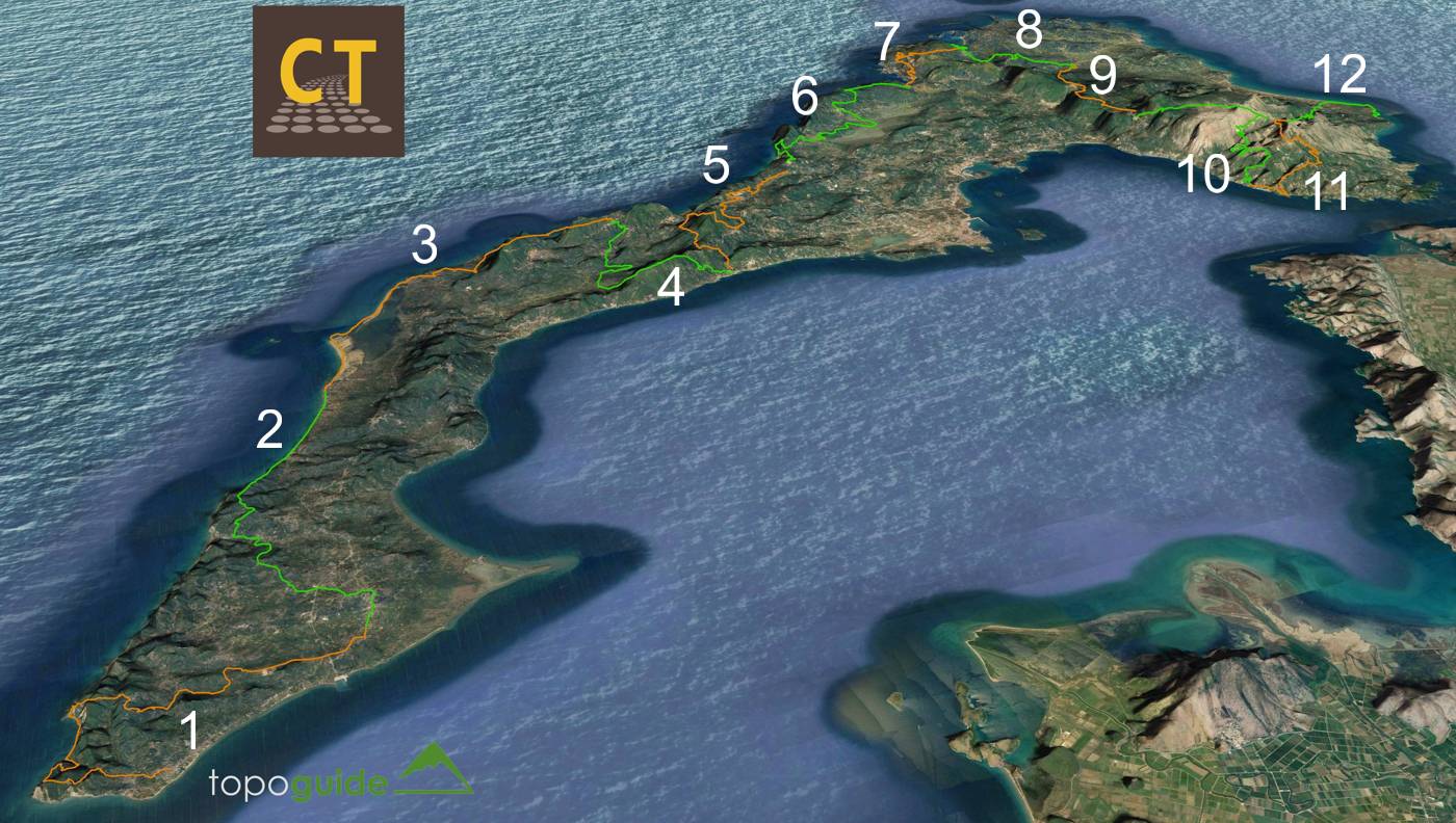
Map of Corfu Trail
Click to enlarge
Map of Corfu Trail
Corfu Trail is marked throughout its length, with a variety of marking methods. The most evident are the yellow square (diamond) signposts bearing the name of the route and usually an arrow pointing the right direction or a N-S direction indication. Signposts are mainly placed in junctions or other debatable points, but one can find them also along a route.
1. Kavos-Lefkimi
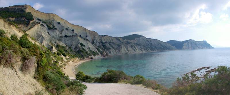
The first section of Corfu Trail from Kavos to Lefkimi (14.5 km, 5h30-6h) starts form the 'official' southern starting point of the route and ends at Lefkimi. The shortest road distance between the two settlements is only 6.2 kms, Corfu Trail, however, follows a particularly intriguing deviation to the south, to pass by the deserted Panagia Arkoudilas monastery, at the edge of the clay cliffs of the southernmost tip of the island. From the monastery, the route returns to Lefkimmi through the quite rural landscape of southern Corfu.
2. Lefkimi-Agios Georgios (south)
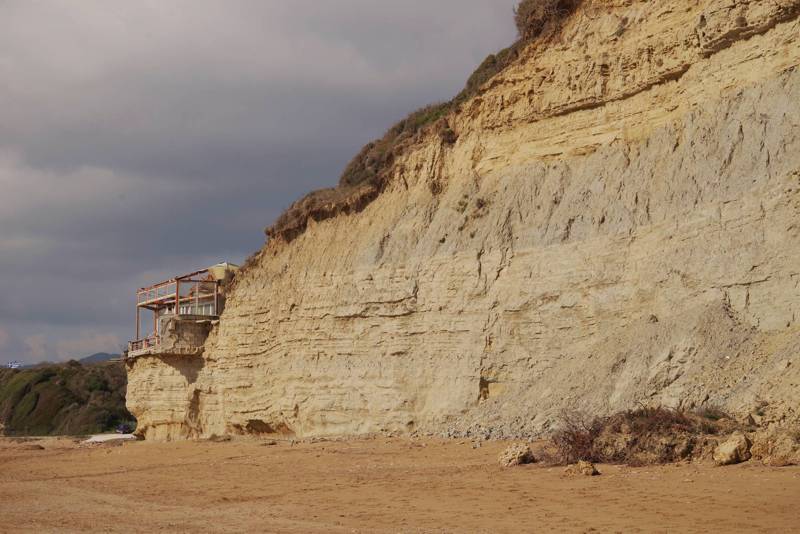
The 2nd section of Corfu Trail from Lefkimi to Agios Georgios (south) (15.2 km, 6h-6h30) follows dirt roads almost in its entire length, among a variety of rural landscapes of the plain. Only its last part, 3.2 km long, follows on the nice sandy coast of the western coast of central Corfu. Although it has no significant aesthetic or hiking interest, this section is at least quite. Note that the route does not meet a single settlement, therefore all necessary supplies should be obtained in advance.
3. Agios Georgios (south)-Ano Pavliana
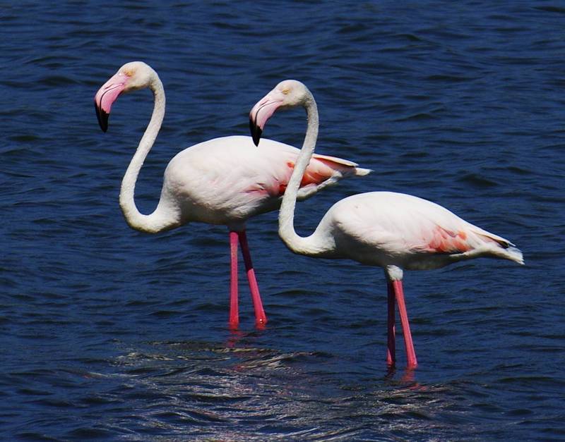
The 3rd section of Corfu Trail runs from Agios Georgios (south) to Ano Pavliana (18.32 km, 7h30-8h) and offers the unique chance of the long-lasting course along a large and very lively wetland. Indeed, shortly after the holiday settlement of Agios Georgios, the hiker will cover 6 km along the sandy strip stretching in front of the large Korission lagoon.
After Korissia, the route follows dirt roads among olive groves, up to the distant Paramonas Beach. The route concludes with a somewhat tiring ascent to Ano Pavliana, a well preserved and quite village of mountainous character.
4. Ano Pavliana-Benitses
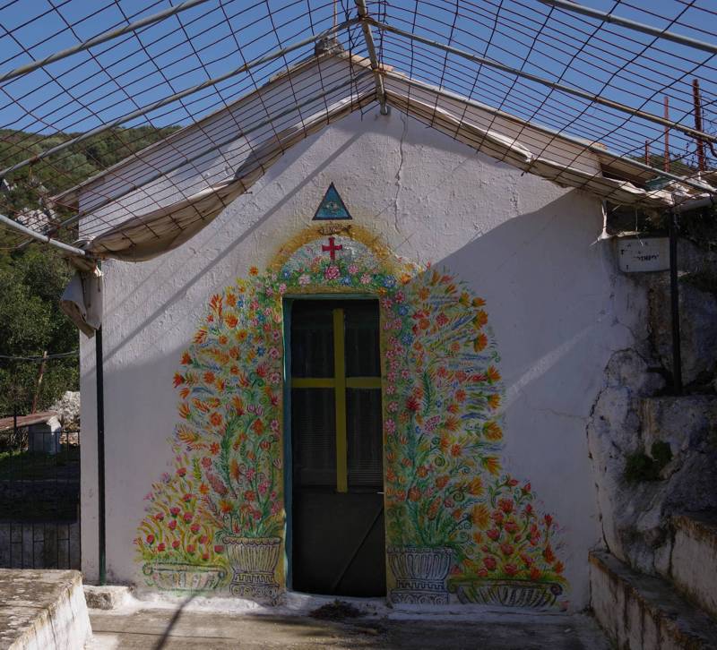
The 4th section of Corfu Trail goes from Ano Pavliana to Benitses (15 km, 5h-5h30) and crosses the island transversely via the nice internal basin of Mesogi. Although hiking among the olive groves is particularly pleasant, it is the section after Strogyli, in the ascent to Metamorfosi chapel and the traverse to Komianata, where the hiker finds again the joy of the nice paths, the open horizons and the multi-level landscapes.
5. Benitses-Pelekas
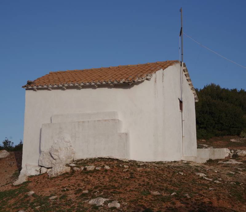
The 5th section of Corfu Trail covers the distance from Benitses to Pelekas (18.4 km, 7h30-8h) and includes all possible compounds and contrasts of the Corfian landscape: from the highly touristic Benitses and the sea sound, we follow the axis of the old aqueduct of the English rule. After the church of Agios Nikolaos follows a tiring ascent to Stavros, as the group of the mountain settlements from Komianata to Markata is called.
After Stavros we ascend to the 2nd highest peak of Corfu, Agii Deka, the most impressive belvedere of the island, which can be spotted from a long distance, as it bears the large white cap of Corfu radar. After the settlement of Agii Deka, we will mostly hike in peaceful dirt roads, passing by Sinarades and ending at the nice settlement of Pelekas.
6. Pelekas-Liapades
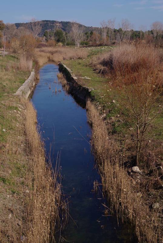
The section from Pelekas to Liapades (22 km, 9h-10h) combines the majority of the several faces of the Corfu: the golden beaches of the western coast, the old paths at Trialos, the lazy peacefulness of the large Ropa valley and finally the vast and variable olive groves from Giannades to Liapades.
7. Liapades-Agios Georgios (north)
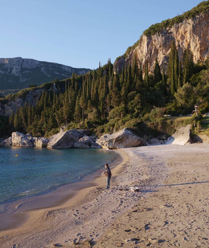
One of the shortest sections of the Trail, the hike from Liapades to Agios Georgios (north) (11.5 km, 4h30-5h) follows the western side of the island and maneuvers through two of the most thrilling landscapes of the island: Paleokastritsa bay, where the pass from Lakones offers unobstructed view to the entire terrestrial enclosure, and the Skala (Staircase) of Makrades, an impressive pass below the vertical rocks and opposite of the long sandy beach of Agios Georgios Pagon. Every step of this winding route reveals the unforgettable contrasts of the solid rock with the immense sea.
8. Agios Georgios (north)-Rekini
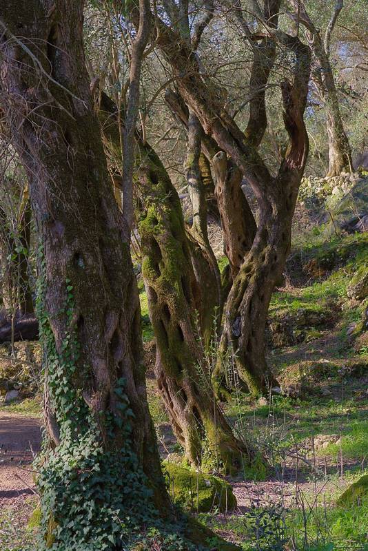
The section from Agios Georgios (north) to Rekini (12.8 km, 5h-5h30) starts the transverse crossing of the broad northern 'head' of Corfu. Leaving the western coast of Agios Georgios Pagon, the route maneuvers through the valleys of the western zone, climbing from village to village, to reach Rekini, a subdued location today, but once a nodal pass from central to NW Corfu
9. Rekini-Spartylas
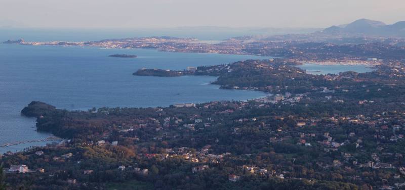
Section from Rekini to Spartylas (11.5 km, 4h30-5) ascends towards the southern foothills of Mt. Pantokrator and gradually enters the typical mountain landscape of Corfu. Even form the Valanio - Sokraki route, we have the chance to cross a distinct semi-mountainous valley with olive groves, waters and lush vegetation and step one of the few remaining 'staircases', the old cobbled paths with the well-planned maneuvers. Next, the route crosses a mountainous basin, through dense Mediterranean forest and meadows, while just before Spartylas we will hike along one of the few mountain vineyards of the island.
10. Spartylas-Kaminaki
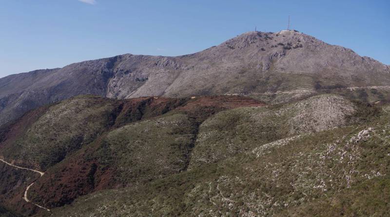
The section from Spartylas to Kaminaki (16.6 km, 6h-7h) leaves the villages and the agricultural landscapes for good and ascents towards the windswept plateaus of Pantokratoras. After the magnificent views of the highest peak of Corfu, we will traverse the valley hiding one of the oldest - perhaps the oldest recorded - settlements of the island, the deserted Palies (Old) Sinies.
After the curves of the final mountain slopes, the route descends from village to village up to the eastern coast and the small Kaminaki settlement. Although the route up to here exceeds 16 km, it might be needed a little more walking to reach an accommodation at Nisaki, Agni or Kalami.
11. Kaminaki-Old Perithia
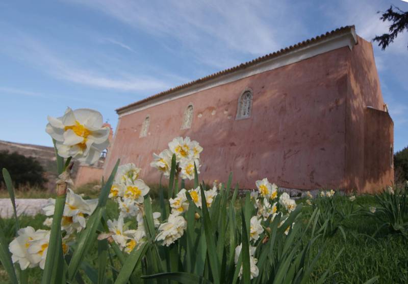
The route from Kaminaki to Old Perithia (12.5 km, 5h-5h30) includes an important altitude difference, without being tiring, however, as inclination is low. Along this course we pass through or near several settlements, which, however, provide only elementary services, even in the summer.
After Megoulas, we follow a somewhat long dirt road (2.8 km), which, however, has constant and ample view towards Pantokratoras and the area of city of Corfu. Reaching the highest point (650 m) we can rest at the kiosk, enjoying the view to both sides of the ridge, under the austere massif of Pantokratoras.
Descent to the beautiful Old Perithia is done on a very good path through the old agricultural zone of the village - where we see threshing floors, terraces and relics of homesteads. Old Perithia, last station of Corfu Trail before the final 12th section, offers a hostel and several tavernas.
12. Old Perithia-Agios Spyridonas
The last section of Corfu Trail from Old Perithia to Agios Spyridonas (11.9 km, 4h30-5h) follows alleys, opposite of the nice Valonia oaks (Quercus macrolepis) thickets, and afterwards good paths and dirt roads through olive groves to descend towards the northern coast of Corfu. The settlements of this unity are small and olive tree remains their only resource: it is what we would comparatively call "the poor Corfu".
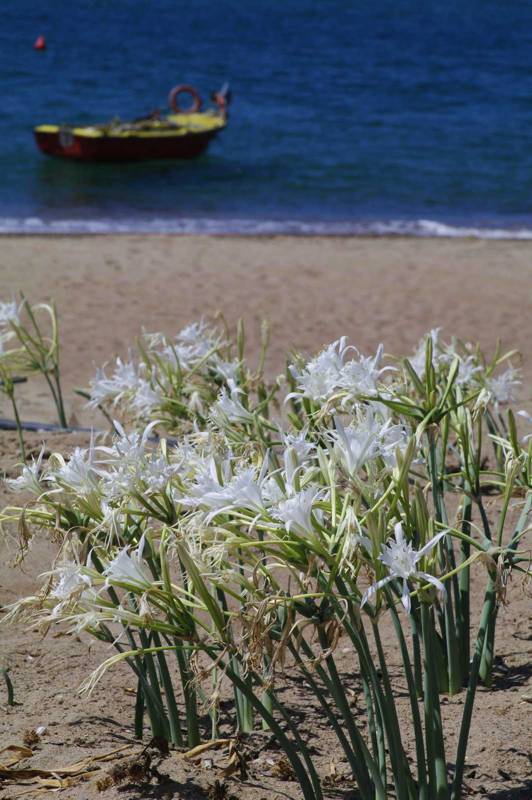
At the end of the coastal course, after the Antinioti lagoon channel, we have 'Nisi' in front of us, a peninsula detached from land by the two channels of the lagoon. We can traverse the peninsula, following a quite alley, or cross it, via a nice and well marked path and passing by the ruined Agia Ekaterini monastery. The two variants converge to an equally nice coastal trail with view towards Agii Saranta (Albania) and end up in the small settlement of Agios Spyridon, next to the mouth of Antinioti lagoon and in front of the nice beach with the sea daffodils (Pancratium maritimum).
topoguide Greece
Corfu Trail topoguide
Corfu Trail topoguide is a unique digital guide for Corfu Trail.
Corfu Trail topoguide is a member of the Long Trails group. Long Trails group includes:
1. Corfu Trail
2. Menalon Trail
3. Nestos-Rodopi Trail
4. Ursa Trail
5. Long Pelion Trail
6. Epirus Trail
7. National Trail Ο22
topoguide Greece provides the possibility to display up to 5 regions or Long Trails at the same time and to search across all their routes and POIs.
Corfu Trail topoguide is available for Android devices as one of 64 regions of Greece offered by the application topoguide Greece. Get the Corfu Trail topoguide as an in-app purchase.
Corfu Trail topoguide is also available for iOS (iPhone και iPad) devices as one of the dozens of regions offered in the hiking application Topoguide Greece. Get the in-app purchase Corfu Trail topoguide and explore Corfu Trail.
