How difficult Menalon Trail is ?
How difficult Menalon Trail is ?
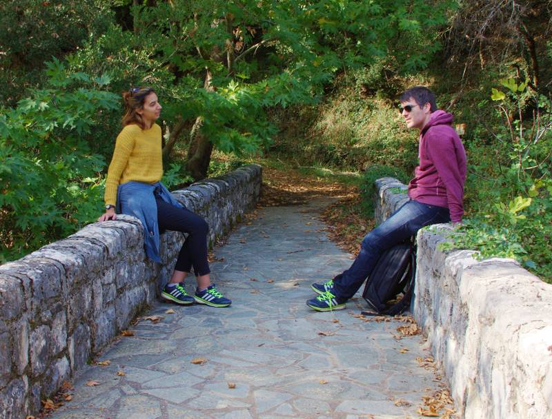
Menalon Trail is a particularly long hiking route crossing a medium elevation mountainous area. Obviously, hiking in the mountainous scenery of Gortynia is subjected to the general conditions of the Greek medium mountain, it is, therefore, a ramble on field of intense relief, under changing weather conditions and with various unpredictable situations.
Hiker should be properly equipped, having himself previous experience on very long hikes or being accompanied by a guide or another experienced hiker and having the cold blood to deal with unpredictable situations (shepherd dogs, hiking for more time than expected, supporting a group member injured or having difficulties). Moreover, even though the route is very well-marked and getting lost is rather unlikely, familiarity with map or mobile navigation application use is necessary. Finally, it is utterly essential a fully-charged mobile phone.
Perhaps the most objective parameters to evaluate difficulty along Menalon Trail are distance and elevation changes of daily sections. The following elevation diagrams allow user to estimate elevation changes. These diagrams are interactive in Menalon Trail topoGuide app, available for both Android and iOS (iPhone and iPad) devices, and therefore users can locate the positions of the main rises/declines. At the same time, for each section the total length is given, as well as the algorithmically calculated walking time, while an indicative evaluation of difficulty is also provided, in a scale from 1 (easy) to 5 (extremely difficult).
1. Stemnitsa-Dimitsana
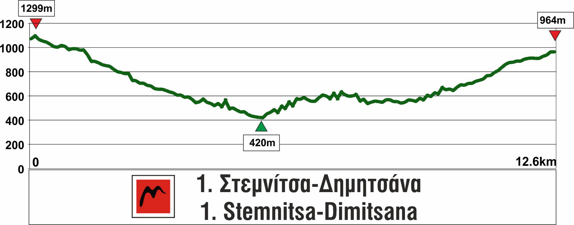
The first section of Menalon Trail from Stemnitsa to Dimitsana is 12.6 km long, estimated that it can be covered in 5-5.30 h. The descent from Stemnitsa to Lousios (Philosophou bridge) is somewhat steep and continuous (therefore, if you plan to cover the route in the opposite direction, from Dimitsana to Stemnitsa, make sure you have adequate stamina for the ascent). On the contrary, the ascent from Philosophou bridge to Dimitsana is rather mild. Hikers will find only one strenuous part, the "skala" (staircase) from Old Philosophou Monastery to New Philosophou Monastery.
The only somewhat problematic point of the remaining route is the short part with the waters of Agios Ioannis springs, running on the path deck, between Tzanis bridge and Paliochori, where attention is needed, particularly in the downhill route. In the winter, the amounts of water can be discouraging for non-experienced hikers or children.
2. Dimitsana-Zygovisti
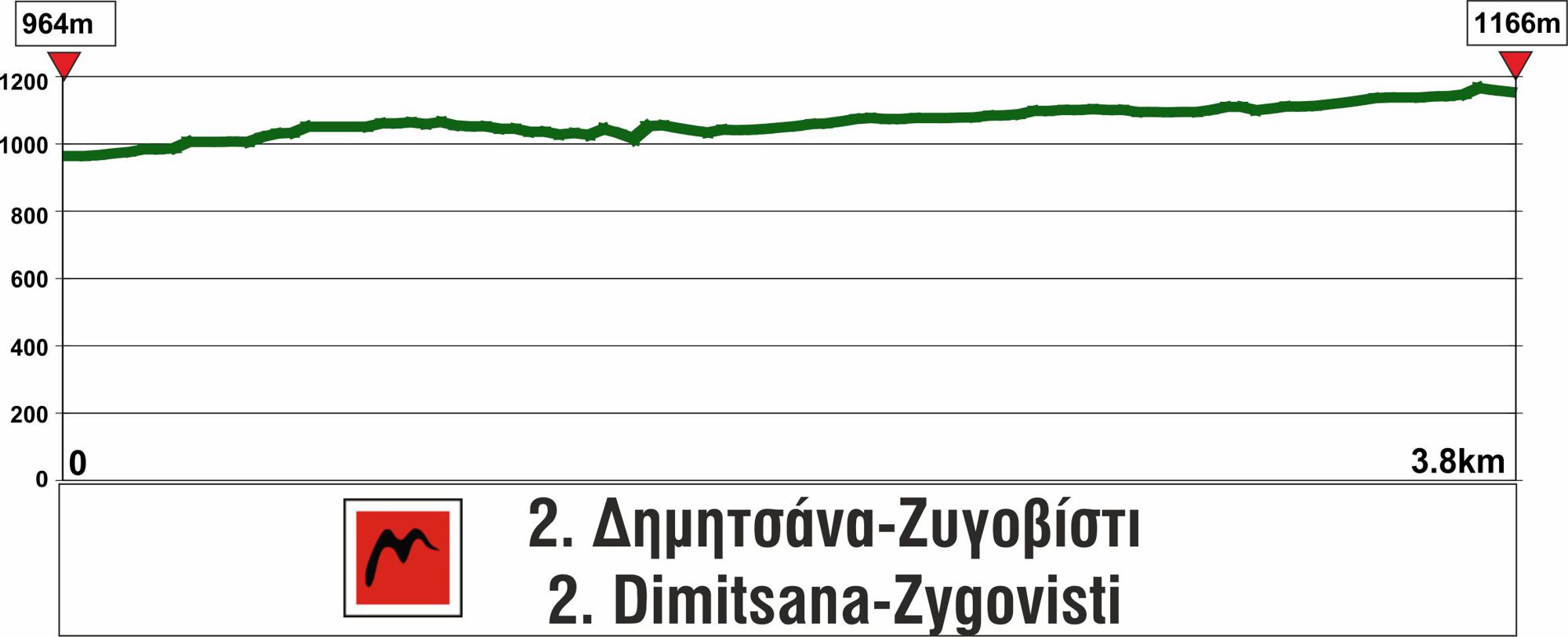
The 2nd section of Menalon Trail from Dimitsana to Zygovisti is 4.2 km long, estimated that it can be covered in 2.30-3 h.
The route has mild slopes and is not at all difficult.
3. Zygovisti-Elati
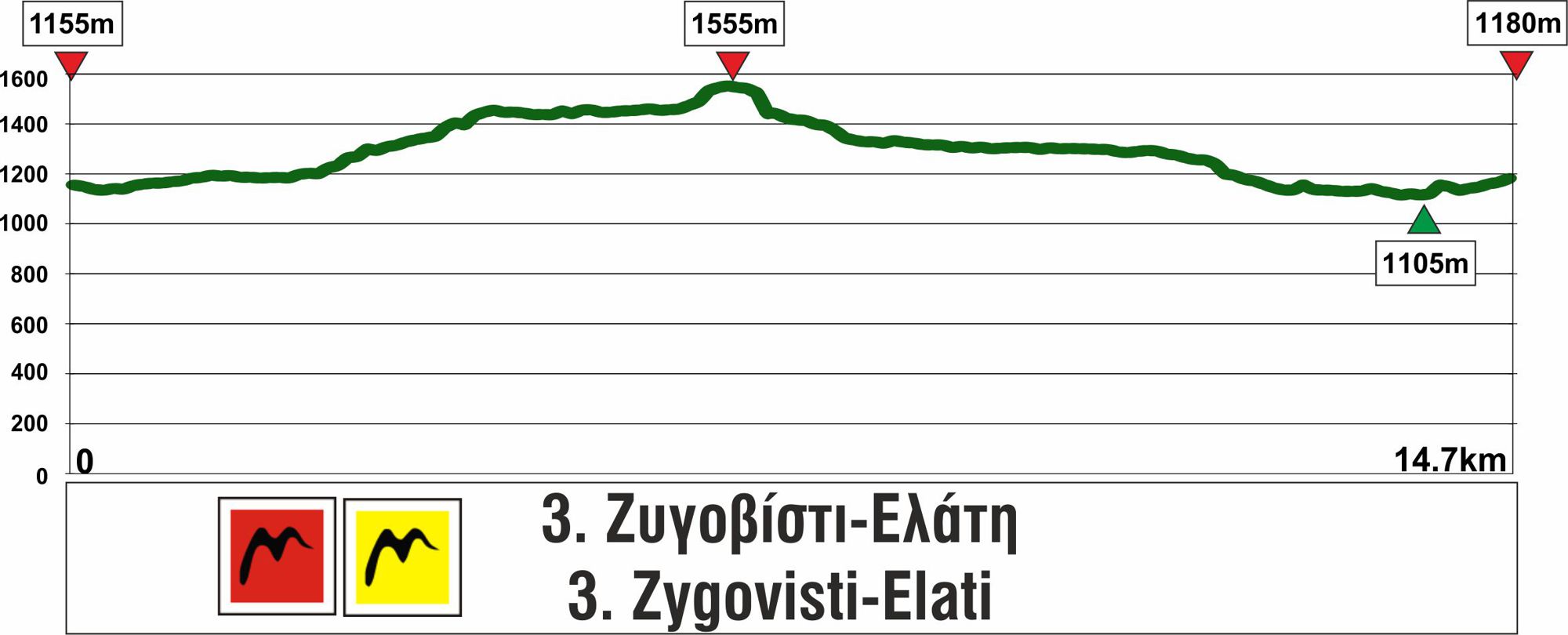
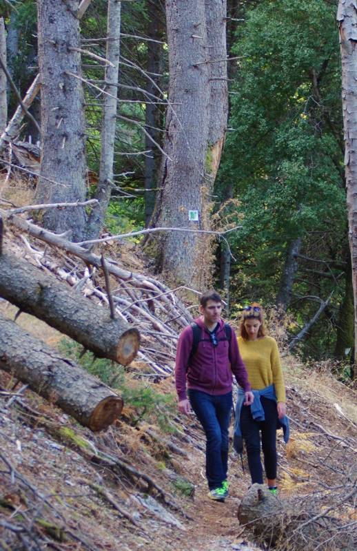
The 3rd section of Menalon Trail from Zygovisti to Elati is 15.1 km long, estimated that it can be covered in 7-8 h.
This section is the longest of the entire route and requires timely start, good pace and group coherence. The uphill-downhill slopes are low throughout, with the exception of a short part in the forest after Koskitsa spring. At the ascent after Asoves and up to Bourniades spring, the inclination of the slope is noteworthy and the use of a hiking stick will be useful. The steepest point of this section can be rough or unstable after rainfalls or during winter.
Note also that it is best not to rely on Koskitsa spring - water dries out in the summer and is not of good quality all in all.
The main problems of this section is the possible presence of snow during winter, as well as the obstacles that might be caused by logging in the summer. You can get relevant information at the coffe house-tavern of Zygovisti.
4. Elati-Vytina
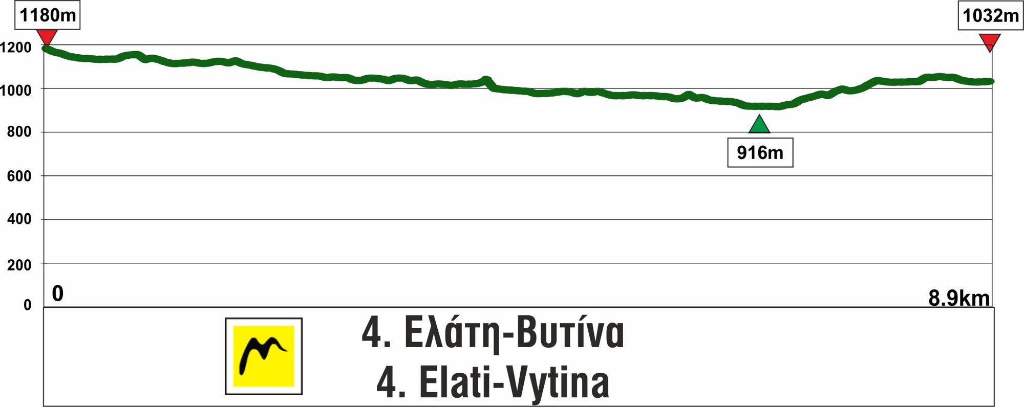
The 4th section of Menalon Trail from Elati to Vytina is 8.6 km long, estimated that it can be covered in 3-3.30 h.
This section has no technical difficulty and is particularly smooth, therefore suitable for families with small children. The springs found along the path provide nice resting options.
Please note that from times to times problems might arise with the shepherd dogs of the pen located at the base of ancient Methydrio hill. The dogs protect the herd there and are fairly aggressive, particularly at breeder's absence. Whether they will become dangerous or not depends also on the behavior of the hiking group: stones and threatening moves are usually ineffective, while a cold-blooded, coherent group - holding also some robust sticks - often defuses tension.
5. Vytina-Nymfasia
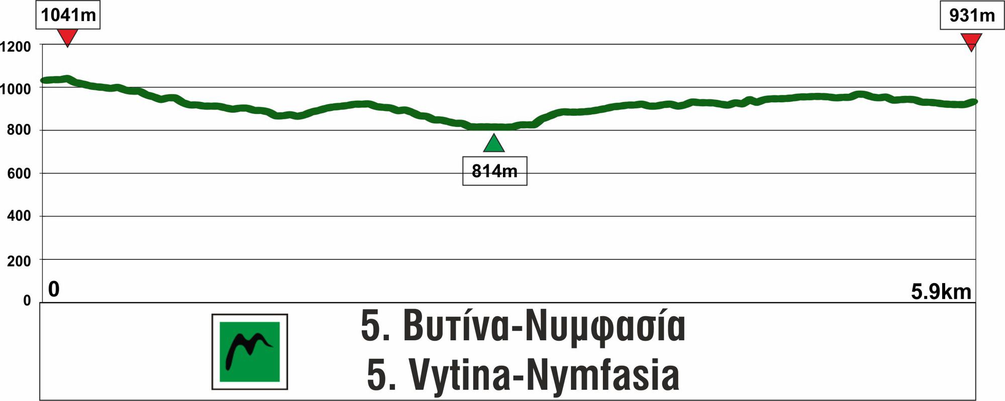
The 5th section of Menalon Trail covers the distance between Vytina and Nymfasia and is 5.7 km long, estimated that it can be covered in 2-2.30 h.
The section is short, with noteworthy scenery and several alternations and is among the most popular of the entire route. Groups of beginners or families should pay a little attention at some points, where the trail is narrow and the terrain might be eroded after rainfalls.
6. Nymfasia-Magouliana
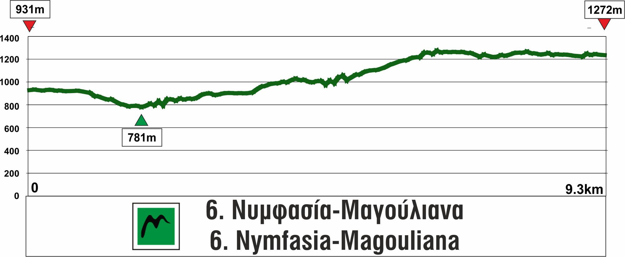
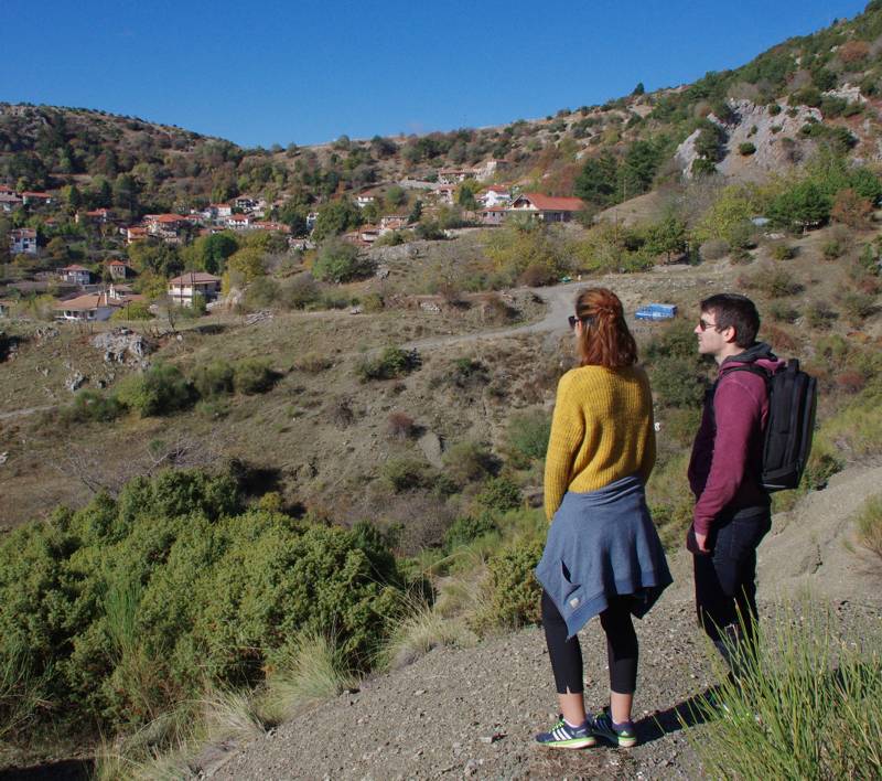
The 6th section of Menalon Trail covers the distancefrom Nymfasia to Magouliana and is 8.8 km long, estimated that it can be covered in 3-3.30 h.
This section starts smoothly and downhill. However, from Kernitsa monastery bridge and up to Magouliana the route is constantly uphill, but with low inclination. Note that there is a newer, better routing from Kalogerolakka up to Sfyrida hermitage, therefore if you have an old map just trust marking. Both Sfyrida hermitage (nice fountain with cold water) and Gavros spring are two good resting points.
7. Magouliana-Valtesiniko
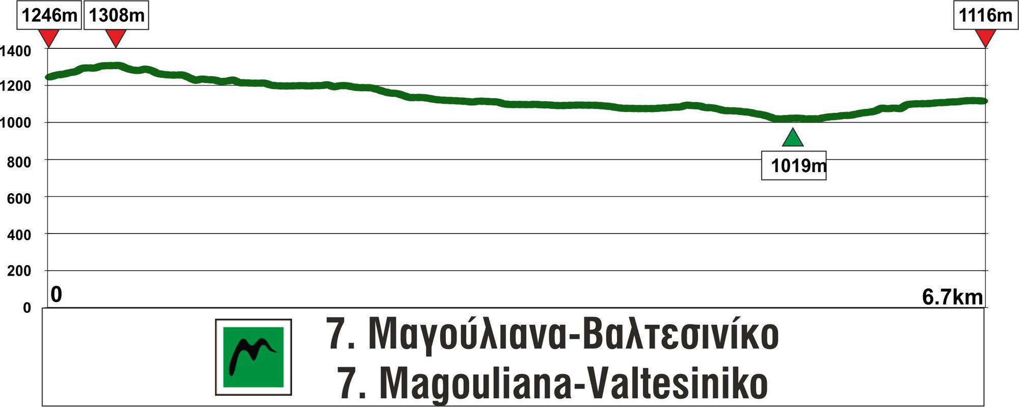
The section from Magouliana to Valtesiniko is 6.7 km long, estimated that it can be covered in 2-2.30 h.
The section does not present any technical or other difficulty, if one excludes the fact that the small streams in the valley of Elas - completely dry in summer - might have plenty of water in the winter, up to a grade of overflowing above their bridges.
8. Valtesiniko-Lagadia
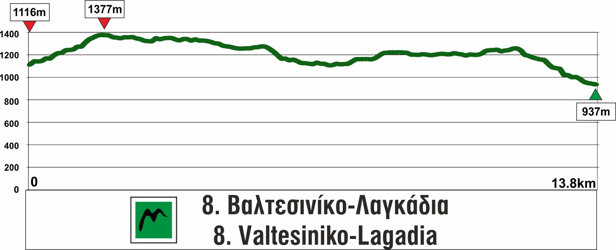
The 8th section of Menalon Trail from Valtesiniko to Lagadia is 14 km long, estimated that it can be covered in 5-5.30 h.
This section is fairly long and, similarly to Zygovisti-Elati section, some scheduling needs before it is covered. The nice fountain Grias Lithari (a few minutes off the route) and Draina Panorama are tow points where you can rest. Note that there is a new routing from Tsapournia col up to Grilas meadow, avoiding the forest road towards Grilas estate. In its new part, the path is not well trodden, but marking is consistent.

topoguide Greece
Menalon Trail topoguide
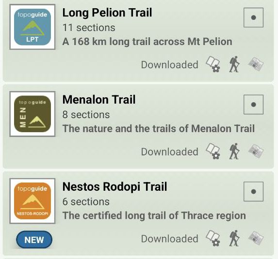
The digital field guide Menalon Trail topoguide is available for Android devices as an in-app purchase within the application topoguide Greece. Menalon Trail is a member of the Long Trails group.
The digital field guide Menalon Trail topoguide is also available for iOS (iPhone and iPad) devices as an in-app purchase within the application Topoguide Greece. There also, Menalon Trail is a member of the Long Trails group.
Menalon Trail topoguide offers active guidance along the trail, as well as an extented guidebook on the geography, the nature and the history of the area.

