Hiking & mountaineering in Prespa Lakes
Hiking & mountaineering in Prespa Lakes
Although the water dominates the landscape of Prespa lakes, playing between attraction and surprise, the mountain component is more decisive: it completes the image, calibrates the sizes, correcting the third dimension and dictating to the visitor the need to gain altitude, even and if only to see the lakes better.
Thus, the desire to tour around the lakes quickly translates into a need for vantage points, for new viewing angles, for a change of perspective. And in Prespa area, where the entire passable road network revolves around the lakes, this perspective can only be offered by hiking.
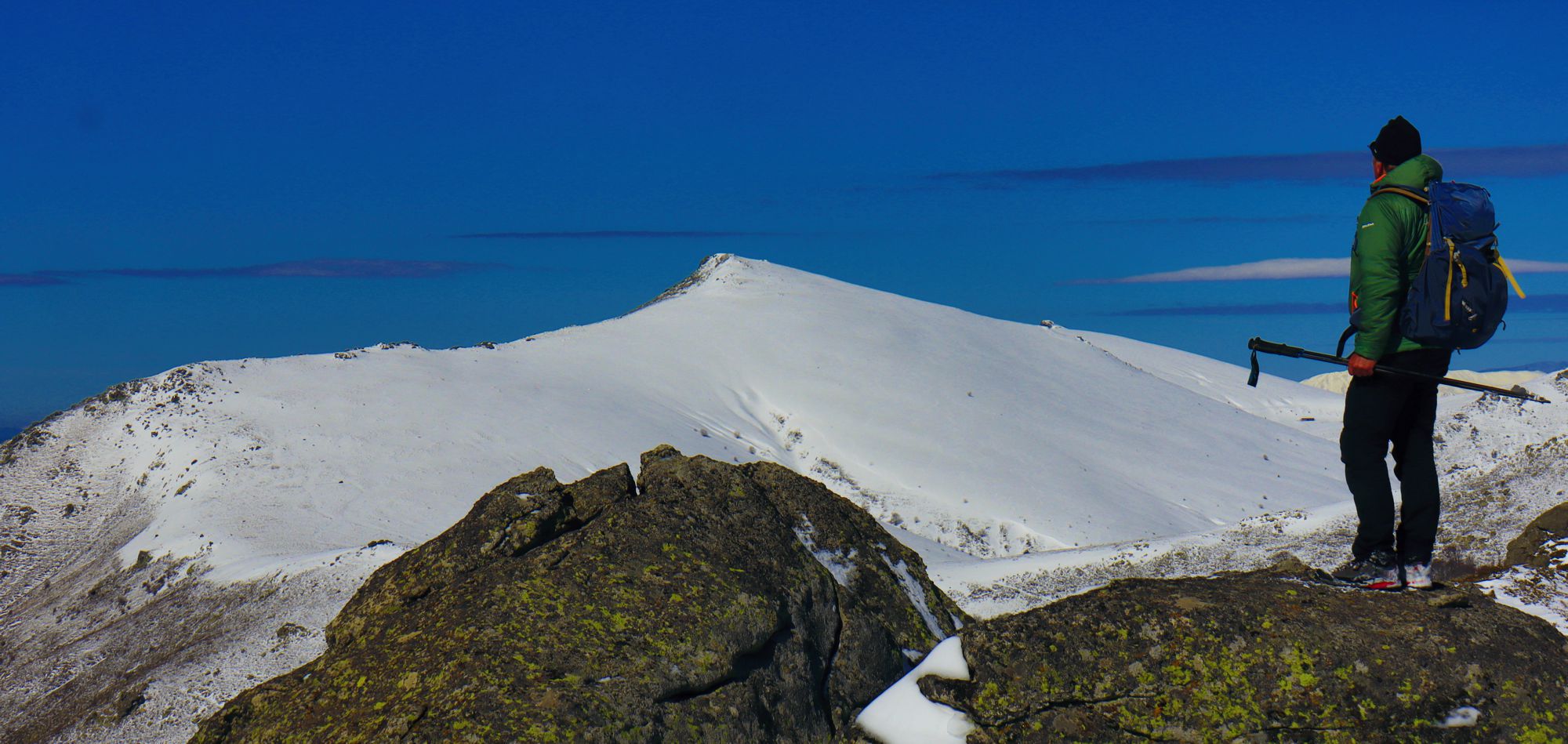
Near the Mt Varnous mountain refuge
(click to enlarge).
Near the Mt Varnous mountain refuge
Currently, the hiking routes in the perimeter of Mikri Prespa, the main terrain accessible through the greek road network, is not well thought out and developed. The known routes, some of which are consistently marked can be organized in the following sections:
- trails along or near the European Trail E6 course,
- trails around Agios Germanos, either easy hiking hikes to Lemos, or more demanding mountaineering routes to Mt Varnous,
- trails along the level area around Mikri Prespa, near the villages of Lefkonas, Mikrolimni and Agios Achilios,
- trails around Psarades, either on the border on Megali Prespa, aiming to the two hermitages accessible on foot, or to Devas peak, the robust mountain dominating both lakes,
- trails around Pyli and Vrondero. The three most interesting hikes of this group can be combined into a longer loop trail.
- trails on Mt Triklari, starting from Mikrolimni or Vatochori. Four trail are known nowadays, converging either on the plateau of Sfika, or on Varba summit, Mt Triklari highest point. These, rather long and demanding hikes, could be combined to create adventurous crossings og Mt Triklari massif.
European Trail E6
As in the rest of Greece, the European Path E6 in the wider area of Prespa is more of an exercise on map than a true hiking proposal.
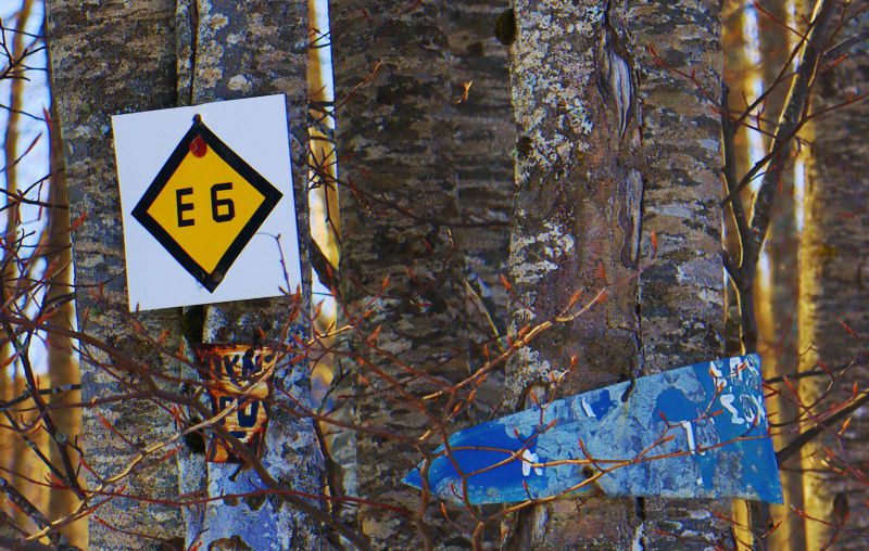
Waymarking of European Trail E6,
on the beginning of the Vigla Pisoderiou-Agios Germanos section
However, despite the outdated conseption and complete abandonment since then, at least one leg of the E6, the connection Vigla Pisoderiou to Agios Germanos, takes advantage of the naturalness of an oreographic bridge and is a really interesting hike, along a beautiful alpine landscapes (that the wind turbines do not manage to spoil) and with a wide view of the surrounding area, where the two Prespa lakes gradually emerge as central elements of the image.
Trails around Mikri Prespa
For the great majority of visitors to Prespa area, the lakes, especially the friendlier and "more greek" Mikri Prespa, are a primary point of attraction. Although the unstable perimeter of Mikri Prespa does not help to create truly lakeside routes, there are several options for easy walks in close contact with the water.
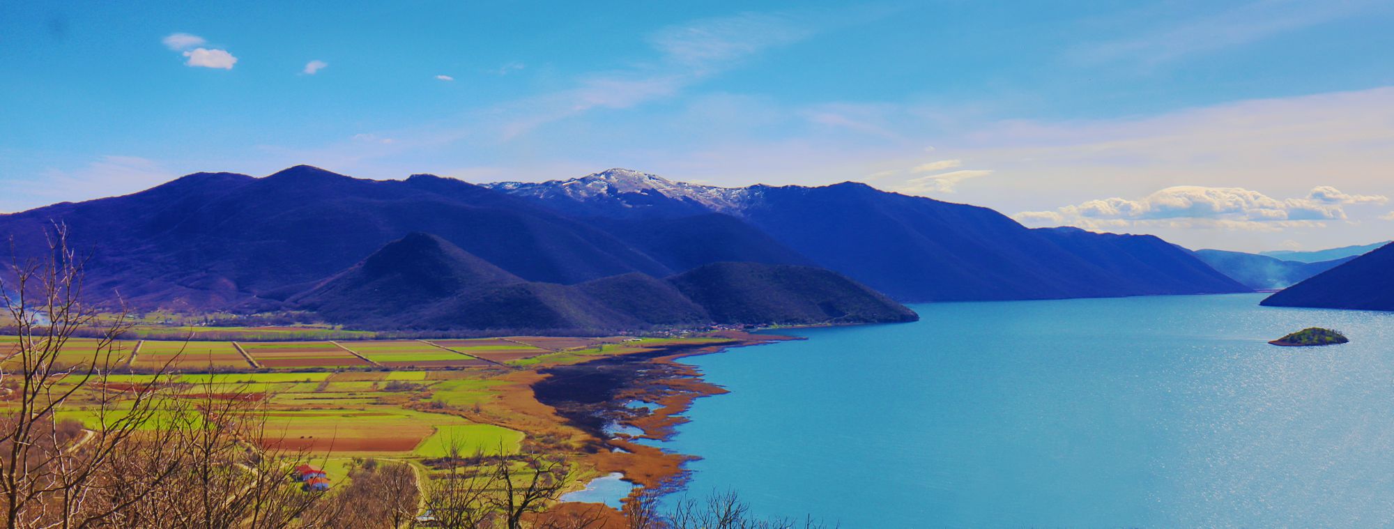
The SW part of Mikri Prespa lake, seen from Kale hilltop
(click to enlarge).
The SW part of Mikri Prespa lake, seen from Kale hilltop
Vidronisi Islet is on the right
The main and most notable member of the group is the Agios Achilios loop trail. The hiker will cross the wooden bridge and after the small settlement will continue along the perimeter of the small island, visiting several very interesting monuments. Another route is the partially marked route Karyes-Lefkonas, which can be combined with a climb to the Kale belvedere, while a more adventurous alternative is the Mikrolimni loop trail.
Trails around Agios Germanos
The seat of the municipality of Prespa, Agios Germanos is a truly special village. The old stone houses create successive surprises with their forms and color, complemented by the old churches and the peaceful atmosphere. Although most services - gas stations, bakery, supermarket - are rather scattered in the vicinity of the village, Agios Germanos is undoubtedly the heart of Prespa lakes.
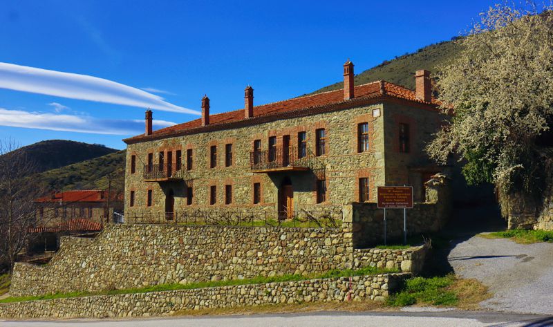
The building of the collection of Byzantine antiquities in Agios Germanos,
a typical example of the mansions of the Prespa area
Agios Germanos is the starting point of both a series of short familiarization hikes and a group of longer mountaneering routes to Mt Varnous.
As far as concerning short walks, we recommend the marked hike Agios Germanos - Lemos and the slightly longer route Lemos - Agios Ioannis which leads at a very interesting view point.
Of very different requirements are the routes Agios Germanos - Bella Voda peak, as well as the long circular route Agios Germanos - Kirko peak - Mt Varnous mountain refuge - Agios Germanos, a real mountain adventures with a wonderful view of the entire Prespa basin.
Trails around Psarades
Mt Vrontero (Tsoutsouli peak) and Devas peak are the highest points of a wider mountain complex, most of which is located in Albanian territory. Although lower than the Tsoutsouli peak (1455 m), Devas peak (1372 m) is more obvious and imposing and dominates the landscape of Psarades, one of the two lakeside villages of Prespa - the other being Mikrolimni.
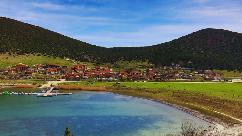
Psarades and the small mooring place
The chapel of Agios Georgios marks the entrance point to the area of Psarades. There begins the long yet easy route Agios Georgios - Devas peak, heading to the top of the mountain. Two more routes explore the two hermitages of Panagia Eleousa and Transfiguration of the Savior and a shorter one leads to Cape Roti, the most advanced point of Greek territory in the body of Megali Prespa.
Trails in the Vrodero and Pyli area
Mt Vrontero is surrounded by a plateau, where the village of the same name - and its previous form, the ruined Old Vrontero - is located. The highest peak, Tsoutsouli, falls sharply towards Mikri Prespa, leaving however a large level zone around its perimeter: here nestles Pyli, a real gate (Pyli means gate, in greek) of the area and here once flourished the - almost invisible nowadays - abandoned settlements of Agathoto and Dasari.
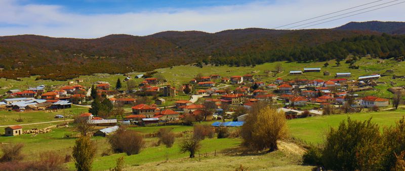
Vrondero is a quiet rural village
From Vrodero begins an easy route that descends to Agathoto. The experienced hiker can continue by the lakeside on the old path Pyli-Dasseri-Agathoto and from Pyli to go up the path Pyli-Vrodero , completing a long circular route.
Near Pyli also begins the path to one of the most famous shelters of the Hellnic Democratic Army during the Greek Civil War era, the Zachariadis cave.
Routes on Mt Triklari
Mount Triklari, together with Mt Varnous, demarcate the Prespa basin from the south. Mt Triklari has a complex structure and a large part of it, rather hilly, stretches in Albania. The highest peak, Varba (1750 m.) and the second one, Falakro (1743 m.) stand out from a series of terraced meadows and are surrounded by beech forests.
Without being steep, Mt Triklari hides a difficult terrain and its upper zone is crossed by a single road passage: an old forest track starting from Kotta in the south side, crossing the pass of Sfika and reaching Mikrolimni. One more col, used by the main road that serves Prespa area, passes through the Pervali pass, i.e. the lowest point of the amorphous mass of silicate deposits that join Mt Triklari to Mt Varnous.
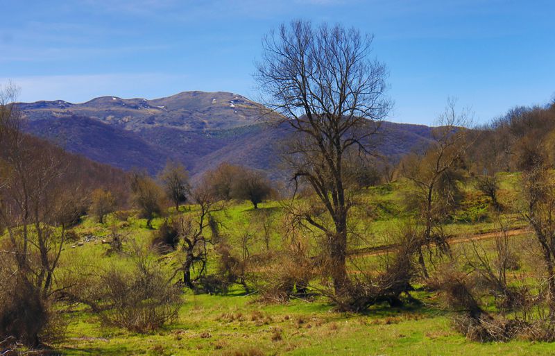
The highest peaks of Mt Triklari from Sfika plateau
Mikrolimni and its small satellite, Oxia, are located at the base of a network of passable or abandoned forest tracks that climb towards a hidden plateau, where the agricultural settlement of Sfika once flourished. On either side of this network, two trails have been marked, the somewhat steepMikrolimni - Varba peak route and the Mikrolimni - Sfika route. The ascent to Sfika plateau crosses the pass of Sfika and leads to the ruins of the settlement of the same name, among which the most impressive is the large three-aisled church, today ruined and without a roof.
At last, the routes Vatochori - Varba peak and Vatochori-Sfika, they have a common starting point in Vatochori, in the south of the mountain, and head towards the highest peak of Mt Triklari and the Sfika plateau, respectively. Although the second one is supposed to follow the trail of the European Path E6, both lines are barely trodden and of course unmarked.
The peaks of Mt Triklari and especially Peak Falakro offer a breathtaking view of the Prespa basin and lakes.
Hiking & mountaineering in Prespa Lakes
| # |
Trail URL |
Length km |
Signage passability |
||
|---|---|---|---|---|---|
| E6 European Trail | |||||
| E6 Vigla Pisoderiou - Agios Germanosς | 17.9 | Moderate. Fairly well marked | |||
| Around Mikri Prespa | |||||
| Agios Achilios loop | 4.6 | Easy. Fairly well marked | |||
| Mikrolimni loop | 4.8 | Easy. Fairly well marked | |||
| Karyes - Lefkonas | 6.5 | Easy. Fairly well marked | |||
| Around Agios Germanos | |||||
| Agios Germanos - Lemos | 3.1 | Easy. Fairly well marked | |||
| Lemos - Agios Ioanis chapel | 5.4 | Easy. Fairly well marked | |||
| Agios Germanos - Kirko peak - Mt Varnous mountain refuge - Agios Germanos | 27.3 | Moderate. Fairly well marked | |||
| Agios Germanos - Bella Voda | 17.1 | Difficult. No marking | |||
| Around Psarades | |||||
| Agios Georgios chapel - Devas peak | 6 | Moderate. Fairly well marked | |||
| Psarades - Cape Roti | 2.3 | Easy. Well marked | |||
| Psarades - Metamorfosi hermitage | 1.9 | Easy. Well marked | |||
| Psarades - Panagia Eleousa hermitage | 6.7 | Passable. Well marked | |||
| Pyli - Vrodero | |||||
| Pyli - Vrodero | 5.9 | Fairly passable. Fairly well marked | |||
| Vrodero - Agathoto | 4.3 | Along a dirt road. Fairly well marked | |||
| Pyli - Agathoto | 11 | Difficult. No marking | |||
| On Mt Triklari | |||||
| Mikrolimni - Mt Triklari (Peak Varba) | 10.5 | Difficult. No marking | |||
| Mikrolimni - Sfika | 8 | Passable. No marking | |||
| Vatochori - Sfika | 7 | Difficult. No marking | |||
| Vatochori - Mt Triklari (Peak Varba) | 4.6 | Difficult. No marking | |||
| Σύνολο | 0 | ||||
The Society for the Protection of Prespa routes
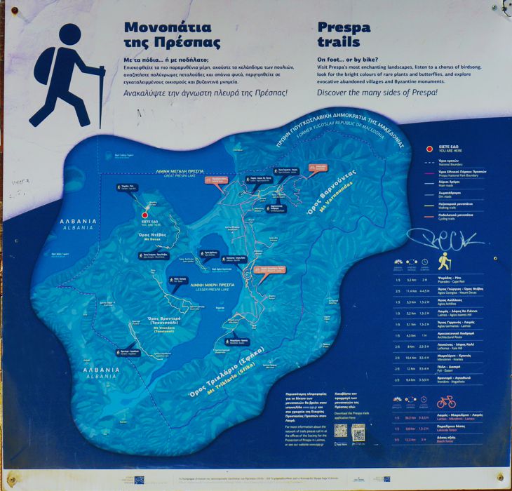
The main board of the Society for the Protection of Prespa routes
The Society for the Protection of Prespa has marked a network of 10 hiking and 3 cycling routes.
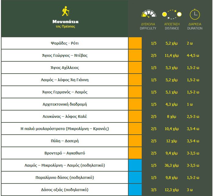
A board summarizing of the Society for the Protection of Prespa hiking network
The hikes are based on pre-existing and previously mapped paths and are marked with hiking and environmental interpretation signposts. Once on the trail, the hiker can follow the well placed destination poles.
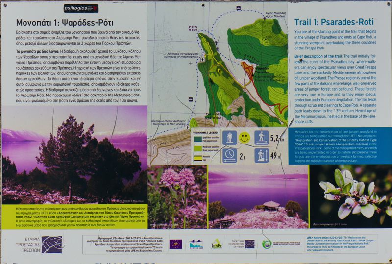
Πινακίδα διαδρομής του πλέγματος πεζοποριών της Εταιρείας Προστασίας Πρεσπών
The routes, which completely overlap with the above routes of topoguide.gr, are in good passable condition and serve an initiation to hiking, covering many of the easy hiking destinations of Prespa lakes.
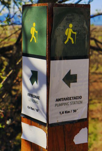
Marks of the routes of the Society for the Protection of Prespa

