topoguides
field guides
for exploring the paths,
the nature and the culture
of Greece
AnaDigit has created the topoguide Greece field guides family for the demanding explorer and traveler. By incorporating cutting-edge technology into cartographic applications, topoguide Greece offers the most complete and reliable field guide.
To date, in the shell of topoguide Greece more than
Unique features
topoguide Greece is a pioneering application, the successor of the paper map and guidebook in the digital era.
topoguide Greece runs off-line (without Internet connection) and is the modern form of the old field guides - not by chance, since it has been designed by the same people who made the best hiking maps and guides in Greece. However it offers an additional element: the active navigation of the user in the field.
Simultaneous display of many regions
topoguide Greece is not just the only application that offers routes, Points of Interest and a guidebook for dozens of areas of Greece. It is a unique digital tool that allows the simultaneous display of many regions, the selection between hundreds of routes and the easy alternation of several guidebooks and endless lists of Points of Interest.
By its very nature, topoguide Greece contains an entire library of digital guides, replacing a large library of paper guidebooks: it is the true portable encyclopedia of Greek natural, cultural and hiking space.
A mature cartographic tool
Although its personality is more oriented towards the interpretation of the terrain, the nature and the culture, topoguide Greece incorporates all the functions of a modern cartographic application: recording and editing of waypoints and tracks and geting navigations from the AnaDigit server.

Waypoint recording is supported by a palette of 187 symbols, organized in 11 groups (Hiking, Nature, Water, Beaches, Geosites, Monuments, Religious monuments, Place-names, Marine, Buildings and Services, Other), plus a group of common graphic symbols for compatibility reasons.
In addition, waypoints and tracks respond to a Search engin and can be graded as Favorites.
Note that KML files exported from topoguide Greece to Google Earth and other compatible data editors, maintain topoguide Greece symbols, displayed as Google Earth symbols.
Easy to opperate
topoguide Greece is a complex cartographic engine, designed and built by scientists with deep knowledge of Geographic Information Systems. Below the visible surface, mapping routines and geometric analysis and search algorithms run non-stop.
Despite its heavy programming and cartographic origins, topoguide Greece strives to be easy to use and user-friendly, thanks to its self-explanatory controls.
Compatibility
The basic structures and functions of topoguide Greece, while constantly evolving, are self-explanatory and remain friendly in haptics and graphics and ensure compatibility with similar known features.
On the other hand, topoguide Greece offers full compatibility to the owners of the previously separate topoguide regions. For example, if the user had Parnitha topoguide and Naxos topoguide installed, topoguide Greece adopts all content from the old apps and updates the Attica and Islands groups with an relevant region.
Step-by-step routing
In the field, topoguide Greece suggests the user a list of Adventures, which are close to him. Once the user selects an Adcenture, he is instructed to approach it.
When the user is on or within a radius of 20m from the Adcenture, the application gives detailed instructions on how to follow it, ie:
- what type of road or path is in front of him,
- how he shall orientate himself in every change of direction,
- how many meters follow until the next significant branching.
Every few minutes, the application displays the Points of Interest and photos of the immediate vicinity: plant species, churches, springs, threshing floors, lime kilns, villages, monuments.
If the user leaves the path, a message urges him to return and the application instructs him to find the route again.
A versatile field guide
Each topoguide Greece region is presented across 4 tools:
 The map
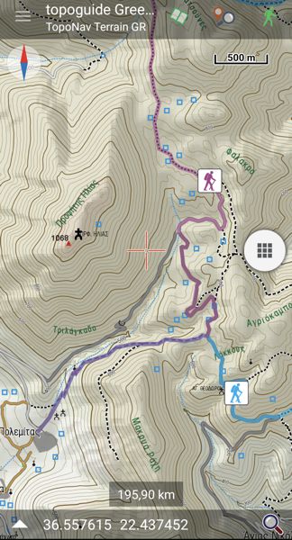
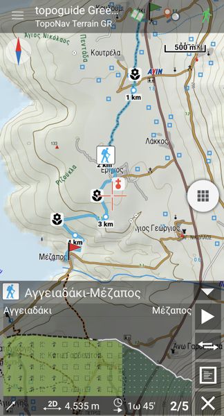
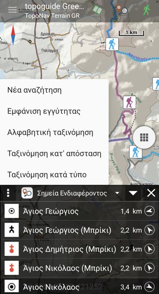
The map environment provides all controls to start the navigation and to record waypoints and tracks. On the same screen, you can display the hiking simulation, with an interactive elevation profile and the nearby Points of Interest and photos.
The map interacts with the Points of Interest through a powerfulSearch engine. The search responds to name and distance criteria and is active as the map moves, ie it constantly displays what is inside the visible map and matches the text and search radius.
 A guide to the advventure, the nature and the culture
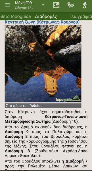
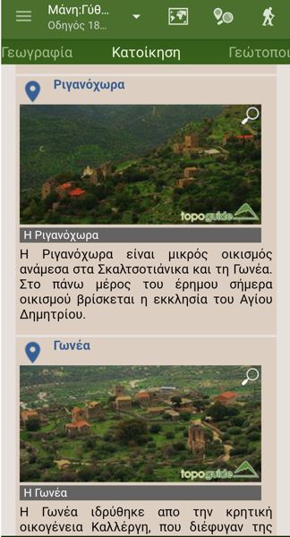
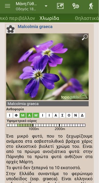
For each region, a multi-page digital guide on the geography, the geology, the nature, the history and the monuments is provided. In each of the above chapters, all the important topics (eg springs, caves, climbing areas, etc.) are detailesd. The texts, as well as the photographs, are genuine and are signed by expert scientists, authors of relevant books and guides for Greece.
 Points of Interest
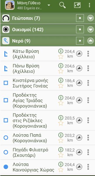
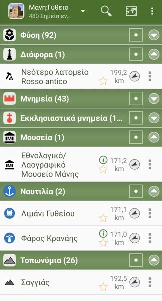
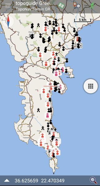
Each region includes hundreds of Points of Interest. The map and the guidebook interaction is ensured via the Points of Interest:
- by clicking the green info symbol next to POI name, you go directly to the corresponding topic of the guidebook.
- by clicking on the POI name itself, you go to the relevant location on the map.
The user can select an entire group of Points of Intrest and display them on the map (such as the hundreds of churches in the area of Gythio, top right).
 Adentures
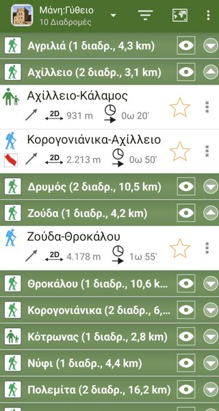
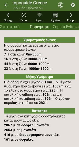
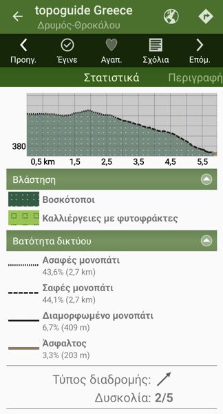
The strongest feature of topoguide Greece is the Adventures. Each Adventure includes a detailed description, photos and its own Points of Interest. Off-field, the Adventure offers a simulation mode, where a Digital Hiker runs along the hike, activating the photos and the Points of Interest. On location, Adventures provide detailed step-by-step navigation instructions. The Adventures of each region are organized in groups of a common starting or destination point.

