

Hiking in Kyparissi, Zarakas, Monemvasia, Vatika and Cape Maleas
Hiking in Kyparissi, Zarakas,
Monemvasia, Vatika and Cape Maleas

Click to enlarge
Despite the difficulties of the seasons and the harsh relief of the region, the hardy people of the South-eastern Peloponnese literally carved in the hard rock endless ways between their villages, the hidden seaports, the castles and various monasteries. Many of these paths were lost under more recent road constructions, but the remaining branches that survived to our days still lead to the most beautiful and wildest places of the area.

More than 40 hiking paths have been marked between the villages of the Municipality of Monemvasia so far. More specifically, five hiking units were formed in Kyparissi, Zaraka, Monemvasia, Molaoi and Vatika.
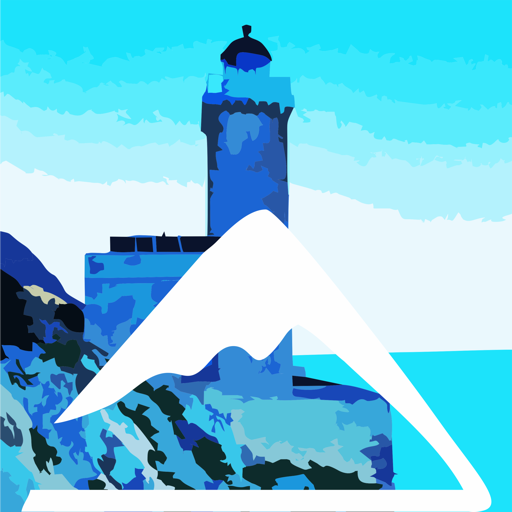
The best parts of this network are the routes of Maleas, i.e. the ancient path that leads to the monasteries of Aghia Eirini and Aghios Georgios Maleas and the path that served the Cape Maleas Lighthouse.
At the same time, the SE Peloponnese is crossed by the southernmost and final part of the National Trail O33.
Bringing together all the hiking trails, AnaDigit created the Hiking, Nature and Culture Guide Monemvasia-Maleas Topoguide, which includes 39 routes with a total length of 295 km.
National Trail Ο33
Sections 6, 7, 8, 9, 10, 11, 12, 13 & 14
The National Trail O33 starts from Agios Petros of Kynourias, where it is connected to the E4, and reaches cape Maleas. It crosses transversely Mt. Parnonas and, after large sections on Mts. Madara, Chirovouni and Gaidourovouni, it then reaches Monemvasia. Many parts of the path follow roads, while the route ends with the impressive part of Cape Maleas. The total length of the O33 trail is 204 km.
The section from Kremasti to Cape Malea includes 9 parts. We propose to divide this large section into the following daily parts: :
- Section 6: Kremasti-Lampokambos
- Section 7: Lampokambos-Richea
- Section 8: Richea-Limeni Gerakas
- Section 9: Limeni Gerakas-Monemvasia
- Section 10: Monemvasia-Lira
- Section 11: Lira-Aghioi Apostoloi
- Section 12: Aghioi Apostoloi-Neapoli
- Section 13: Neapoli-Velanidia
- Section 14: Velanidia-Cape Maleas
After the crossing of Mt. Chionovouni (Kremasti-Lampokampos section) by mountainous dirt roads and livestock trails, the O33 continues towards Monemvasia on asphalt roads. This unfortunate solution is due to the fact that the relief and the old paths that have survived to our days are transverse and not longitudinal to the area. Thus, the hiker is forced either to follow rather ugly roads (with quite some traffic in summer) or to move by vehicle.
The path from Monemvasia to Lira is more satisfactory but the situation from Lira to Velanidia is dramatic. Obviously, the hiker who decides to cross the O33 will have to study the maps of the area and identify better solutions. The Monemvasia-Velanidia link can be made from the coast, in the succession of Monemvasia-Trochalia-Xifias-Aghios Fokas (main roads) and then Ano or Kato Kastania from a path, Aghios Pavlos of Velanidia, and finally Velanidia. This version includes paths that are not marked and are not maintained, so there are likely to be accessibility problems.
Kyparissi Section
Routes X1, X2, X3, X4, X5, X6 & X7
A large and complex network of hiking trails has been built around Kyparissi. The routes take advantage of the old paths between Kremasti and the settlements of Kyparissi (Vrysi and Mitropoli) and some rural spots.

Three more fairly long paths, marked with X3, X4 and X5, connect the settlement of Vrysi with these two long routes, passing through Paleochora and the Plateau Babala, while a smaller one leads from Kyparissi Beach to Agios Georgios (route X6)..
To the same section belongs, finally, the route from Charakas to Piliza beach (route X7).
Zarakas Section
Routes Z1, Z2 & Z3
The section of Zarakas includes three routes, which are not connected to each other.

Easier is the small circular walk of Ancient Zarakas, a route that combines wandering in the peculiar natural landscape of the bay with the archaeognostic interest.
The much longer hikeAghios Gioannis-Loggari-Konteika leads to the old settlement of Loggari - which is deserted today, where the cryptic and remote location allowed the preservation of the authenticity of the built landscape’s physiognomy.
Monemvasia Section
Routes P2, P20, P20a & P21
The trails of the Monemvasia area, apart from being very interesting, are a very good introduction to hiking in the area - and hiking in general. Two parts of National Trail O33, the 9 and 10 more specifically (see above), converge at Monemvasia’s Bridge, where also ends the beautiful route Π2Aghios Nikolaos-Monemvasia, which starts at the mountain village of Aghios Nikolaos.

Last, the beautiful circular trail Circular trail of Monemvasia, which goes all along the islet's shores, is well marked on the ground although it has no sign posting.
Molaoi Section
Routes M1 & M1a
Molaoi is the largest settlement and the most important commercial and administrative center of the region. The settlement was formed at the base of Mt. Strongyla, at the exit of a stream carved deeply in the rock, whose abundant waters allowed the village’s to become a wealthy agricultural small town.

Diamonia-Xyli-Asopos Section
Routes A1, A2 & A3

A route has been marked in the area of Diamonia, which connects Talanda with Charakia Beach. The route follows the larger Charakias stream, which is also the shortest way.

One of the most beautiful routes of the whole network (code A2) runs through the Xyli Peninsula. We suggest a circular route that takes advantage of an inner dirt road for returning to the starting point.
The ascent to the Asopos Paleokastro in another very interesting route of the area. The Byzantine fortress built like a crown on top of the monolith offers us lessons in the geography of the region.
Neapoli Section
Routes D1, D1a, D2, D3, D5 and D8
Starting from the coastal town of Neapoli, we can follow several trails towards the mountainous villages of the area.
The route Neapoli-Mesochori follows mainly dirt roads, like the route that connects Mesochori to Faraklo.
The old connection Faraklo-Paradeisi, which used to be the best hiking trail of the area, has now various grades of difficulties due to poor walkability.
On the contary, the route Mesochori-Profitis Ilias-Paradeisi, which mostly follows natural trails, is well maintained and offers beautiful views over the area.
Malea Section
Routes D10, D11, D13 & D14

Click to enlarge
Quite unexpectedly, the most beautiful paths of Vatika – which are also among the most beautiful of Greece - are located on the eastern-most southern tip of the Peloponnese, on Cape Maleas.
The first route starts at the small port of Profitis Ilias, passes then through Aghia Marina and ends at the Aghios Georgios church, the last point that a person can reach. This path can be done in two parts, the part Profitis Ilias-Agia Marina is a beautiful coastal path that can also be made into a circular walk, while the part Aghia Marina-Aghia Eirini Monastery is a demanding footpath with a very particular character.

Click to enlarge
Two further trails, the crossing of Mt. Krithina from Velanidia to Aghia Marina and the climb to the German Watchtower complete the table of the main hikes of the Maleas Section.
Text and photos by T. Adamakopoulos
topoguide Greece
A GUIDE FOR KYPARISSI, ZARAKAS,
MONEMVASIA, VATIKA AND CAPE MALEAS
The guide Monemvasia topoguide is available for Android devices along with dozens of other regions of Greece, within the general application topoguide Greece. Monemvasia topoguide is a member of the Pelponnese group. Get Monemvasia topoguide as an in-app purchase from the topoguide Greece available regions list.
The Gythio topoguide guide is also available for iOS devices (iPhone and iPad) through the general hiker application Topoguide Greece. Get Monemvasia topoguide as an in-app purchase via the available regions list.
It is very interesting that topoguide Greece has the ability to simultaneously display up to 15 different areas, thus allowing an overall view of the Peloponnese and the easy alternation of hundreds of hiking routes, hundreds of Points of Interest and dozens of pages of the guide with innumerable photos.
