Hiking along the Mycenaean landscape
Hiking along the Mycenaean landscape

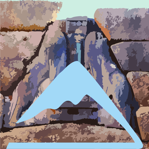
Click to enlarge
Despite all the changes in the way we approach the mountain today compared to the heydays, the mountain range of Nyfitsa, from the passage of Kontoporeia in Agionori to the Mycenaean roads, in today's Mycenae, hides several opportunities for relatively long hiking trails.
Hiking in the area of Mycenae is attractive for two main reasons: on the one hand the low altitudes allow hiking all year round, and on the other hand it can be combined with a visit to the innumerable cultural and archaeological sites of the narrow or wider zone.
Some of the hiking connections, such as Mycenaean Road, were known and marked already in the past, while others were created or marked recently. Inevitably, the resulting routes sometimes have a large percentage of dirt road. In any case, these are completely deserted rural roads, which have simply been opened on the old paths.

To sum up, the ancient area of Mycenae gathers 12 routes. With its variety, magnificent view, joyful natural environment and rich cultural heritage, Mycenae area constitute one of the most interesting small hiking spots within the radius of the one-day or two-day excursion from Attica.
Around Mycenae

In the wider area of Mycenae, apart from the Mycenaean Road, the most interesting pathways are:
- Prosymna-Stefani trail, followin the old path between the two villages,
- the ascent to Agiolias, ie the top of the steep mountain Charvati, which apart from a small chapel dedicated to Prophet Elias bears the remains of an ancient tower,
- the ascent to the Prophet Elias Vaserka, which offers perhaps the best view of all of Argolida,
- and finally the rather long route Stefani-Profitis Elias, which runs over a long ridge with excellent views of the mountains of Mycenae.
Tenea-Kontoporia

In the northern part of the Mycenaean region, the most interesting routes are:
the connection Agionori-Klenia, a mountainous variant of Kontoporeia, which passes through Panagia Muskofitsa,
- the Voukina Gorge, which connects Athikia with the remote Agios Ioannis,
- the pathway of Nikitaras, which exploits a part of the Hadrian's Aqueduct and connects Agios Vassilios with Dervenakia,
- the route Stefani-Agios Vassilios, which is a nice crossing from Stefani to Agios Vassilios, passing through the ruins of Agios Antonios, on the main crestline of Nyfitsa mountains,,
- finally the two loop trails starting from Agios Vassilios, that is the small loop in Agios Vassilios, a route with rich cultural interest and the largest loop trail Agios Vassilios-Agia Triada, passing through the meadow of Agia Triada.
Text and photos: T. Adamakopoulos
topoguide Greece
A GUIDE FOR THE TRAVELING
ALONG THE MYCENAEAN LANDSCAPE
The guide Mycenae topoguide is available for Android devices along with dozens of other regions of Greece, within the general application topoguide Greece. Mycenae topoguide is a member of the Pelponnese group. Get Mycenae topoguide as an in-app purchase from the topoguide Greece available regions list.
The Mycenae topoguide guide is also available for iOS devices (iPhone and iPad) through the general hiker application Topoguide Greece. Get Mycenae topoguide as an in-app purchase via the available regions list.
It is very interesting that topoguide Greece has the ability to simultaneously display up to 15 different areas, thus allowing an overall view of the Peloponnese and the easy alternation of hundreds of hiking routes, hundreds of Points of Interest and dozens of pages of the guide with innumerable photos.