Castles and towers of SE Peloponnese
Castles and towers of
SE Peloponnese
The zone from Kyparissi and Zarakas up to Monemvasia, Vatika and Cape Maleas is made up by a richer hinterland lying behind a vulnerable coastline.
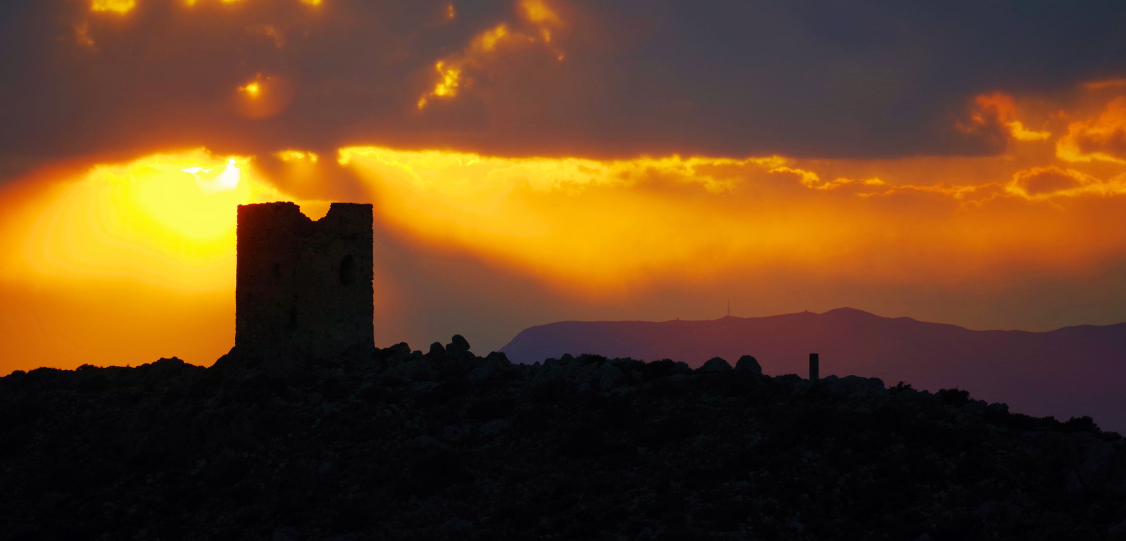
Monemvasia itself, endowed with its unique defensive features, was the safest pole in the region. However, the small economies of the area's villages, stretched out just behind the coastline, were extremely exposed to piracy and aggression. The main defensive strategies against the landing of enemy forces were crypticity, warning systems and physical refuges.
Click to enlarge
The needs of being invisible, get warning early and sheltering efficiently were faced with the three-fold strategy: scattered habitations, supervision of the vulnerable places and fortification. Thus, the villages were built hidden, in positions even naturally disadvantaged, while locals invested in the construction of watch towers along the coast and in the creation of citadels, castles and hides in the hinterland.
The result of this strategy is obvious even today: many villages are remote, hanging on steep slopes, without water and with difficult road access. Around them, every naturally defensive position has been converted into a cave church, a "refuge" or a hermitage, while the monasteries are located in completely inaccessible locations. Finally, on the shoreline were built the notorious "viglaes", robust watch towers used for monitoring and alert.
The coast between Elia and Skala of Elafonisi and the location of the towers of Elia, Koulentianos and Fonias is a typical case. This zone had - and still has - minimal human presence and was very suitable for an undetected pirate landing.
On the other hand, the location of these three towers is reminiscent of the topography of the Genoese towers of Chios island, whose main purpose was to prevent the exportation of the main resource of the island - mastic. Here, of course, there is nothing worthwhile to extract - the ferrous deposits of Aghios Elisseos had a low value-to-weight ratio. However, the question remains: are we dealing with simple "eyes" towards the sea ?
Castles and towers of Monemvasia
The Castle of Monemvasia
Click to enlarge
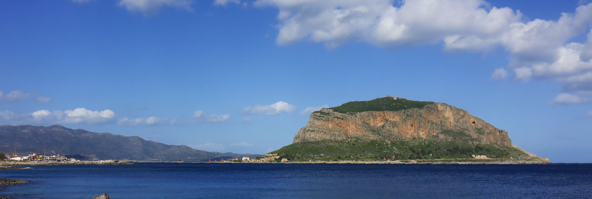
Monemvasia was one of the most important castle towns of Greece. Born to meet the challenges of an extremely turbulent 6th century, the citadel never lost her shine and thanks to her amazing energy she still attracts much interest. Monemvasia is today one of the inescapable tourist destinations of the Peloponnese.
In Monemvasia the rock, the citadel and the castle are one. The fortified settlement was founded by the Byzantines in the late 6th century to offer protection, against land and sea raids, to the inhabitants of the wealthy zone around the open bay of Epidaurus Limira.
Thanks to the administrative, ecclesiastical and financial privileges granted to it, the city developed into a marine and commercial station in the western Aegean and at the same time became an important administrative and ecclesiastical center of the eastern Peloponnese. Since the 15th century, due to geopolitical upheavals, the influence of Monemvasia lost part of its range and became bounded to Zaraka and Vatika, to the north and to the south respectively.

Click to enlarge
The organization of the castle and settlement is basically constraint by the site's topography, which dictates the location of the bridge, of the "Kato" (=lower) and "Epano" (=upper) Poli (=town), and of the castle's structure. All four parts (the bridge, the towns, the castle) are fortified, to the extent that the utilitarian building and the defensive units merge int one piece.
From the mainland we can access the city only from the bridge. The narrow strip of land, which gave the name to the rock (Monemvasia = unique approach, unique way of access) leads to the rocky zone and then to the Kato Poli, which remains invisible from the mainland.
Click to enlarge
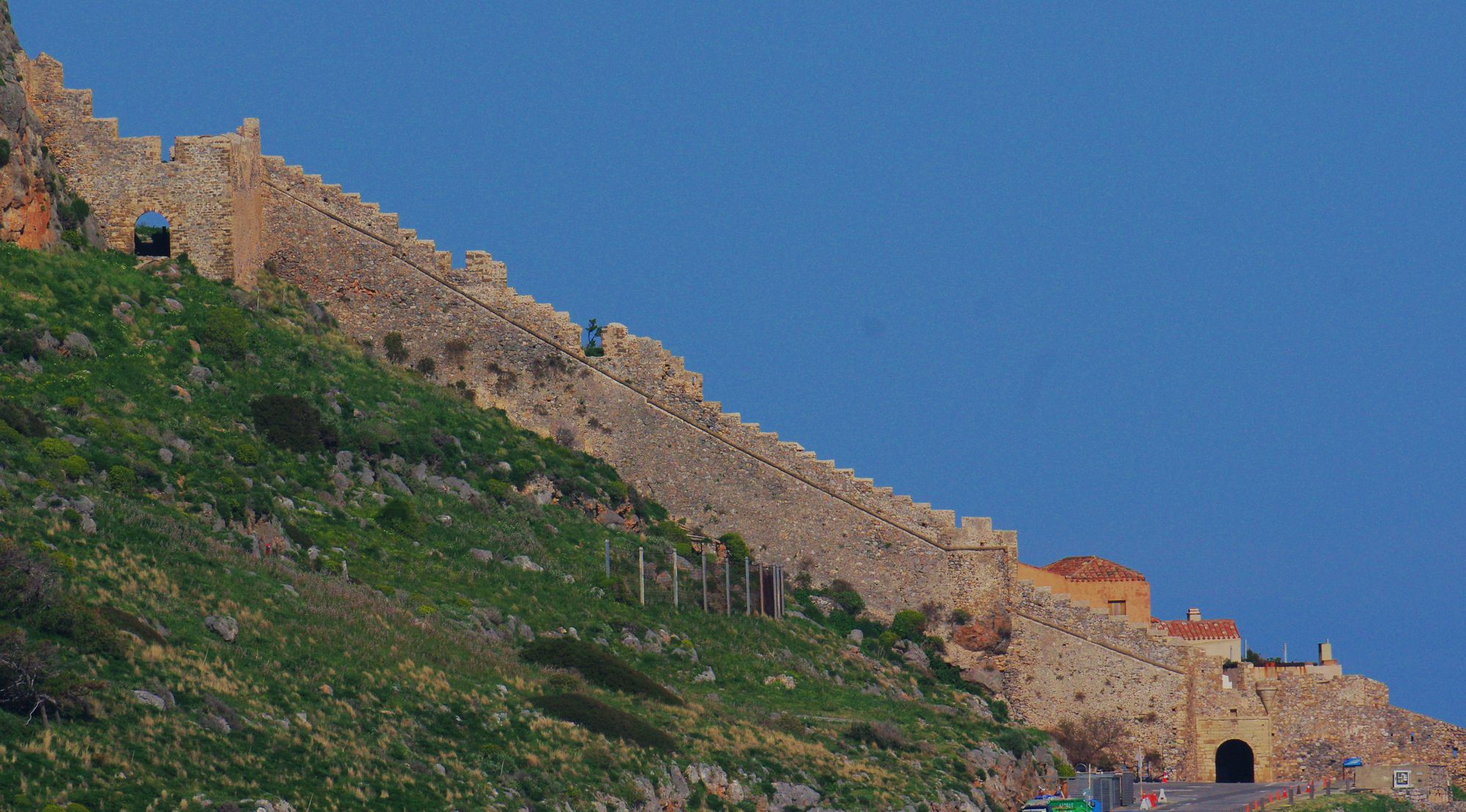
Kato Poli is protected by a big wall, which complements to the inaccessibility of the sea and the rock. As a real fortress, the lower citadel has a central gate, a protected passage to the sea (the so-called Portello), a gate to the west and a gate towards the Epano Poli.
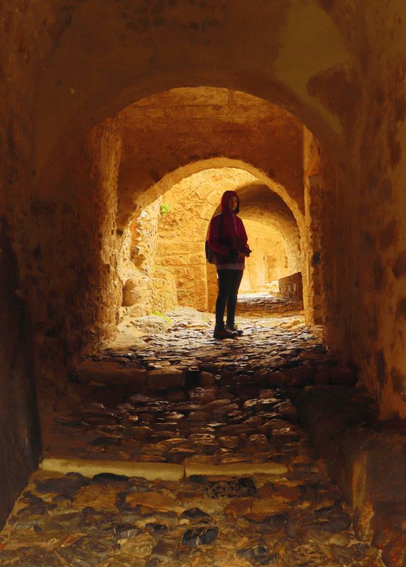
The road that climbs to the Epano Poli is another "unique access way" and is part of the defensive apparatus of Monemvasia. The entrance to the plateau is through a robust gate to a well-controlled passage. Here was the house of the city's governor during the Venetian rule, and a little higher stands the imposing church of Agia Sophia. The Epano Poli was a fairly large and well-fortified area, with guards, military installations, mansions and a citadel.
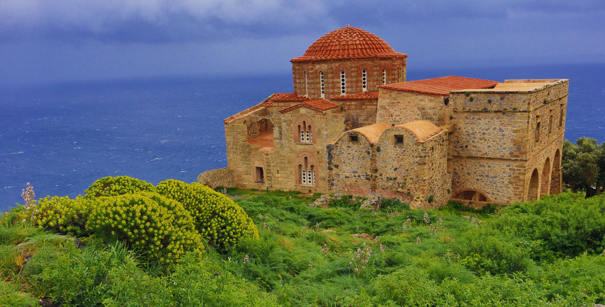
Click to enlarge
There were countless small and several large cisterns. In the center of the settlement there was a complex with fountains, while a little above the Αgia Sophia there was an Ottoman bath.
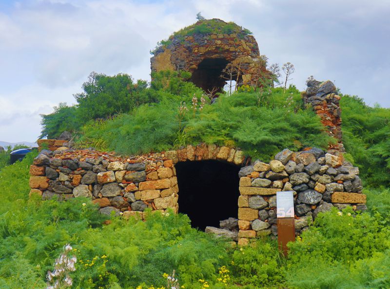
The castle occupies the entire flatter part of the coronation of the rock. The wall has a trapezoidal shape with towers in every corner. Most of its defence virtue is offered by the rock itself.
The tower of Palea Monemvasia
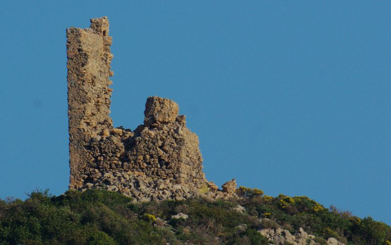
The small settlement of Palea Monemvasia was built on the shores of a south-looking small bay, just north of Monemvasia. For the rest of the coastline had no harbors, the protected harbor of Palea Monemvasia was of great importance for the area and was guarded by a tall rectangular tower.
The tower has collapsed and only the ruins of its northern façade remain today. From the few constructional features that can be distinguished, it seems that it belongs to the period of the Venetian rule.
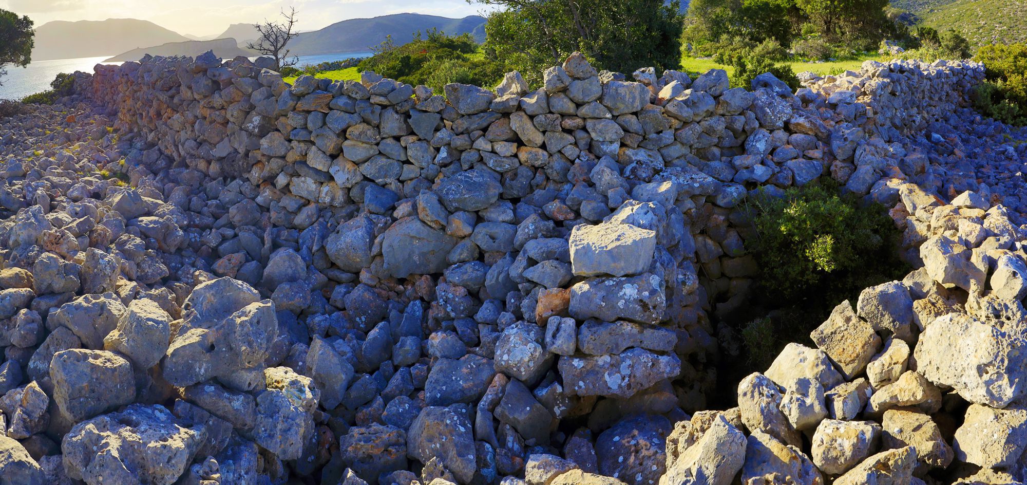
Old fortification in Klissizes
Click to enlarge
Small fortification of rough stones on a rocky outcrop with a flat crown, in the Klisizes district, near the road from Palea Monemvasia to Gerakas.
Only the NE side was fortified, as it is not protected by the cliffs. On the NW face of the hill there is a large pothole, which protects efficiently this side.
The materials and the construction do not allow the dating of this small fort.
Castles and towers of Molaoi area
The Paleopyrgos of Molaoi
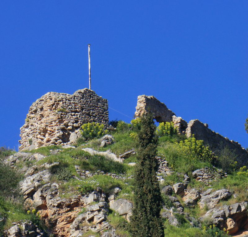
Ruined fortification built to control the gorge of Larnaka, high above the town of Molaoi. It is considered one of the forts built by the Despots of Mystras (the others are those of Zarafona and Socha). It was built between the end of the 14th and the beginning of the 15th century.
Vigla of Molaoi
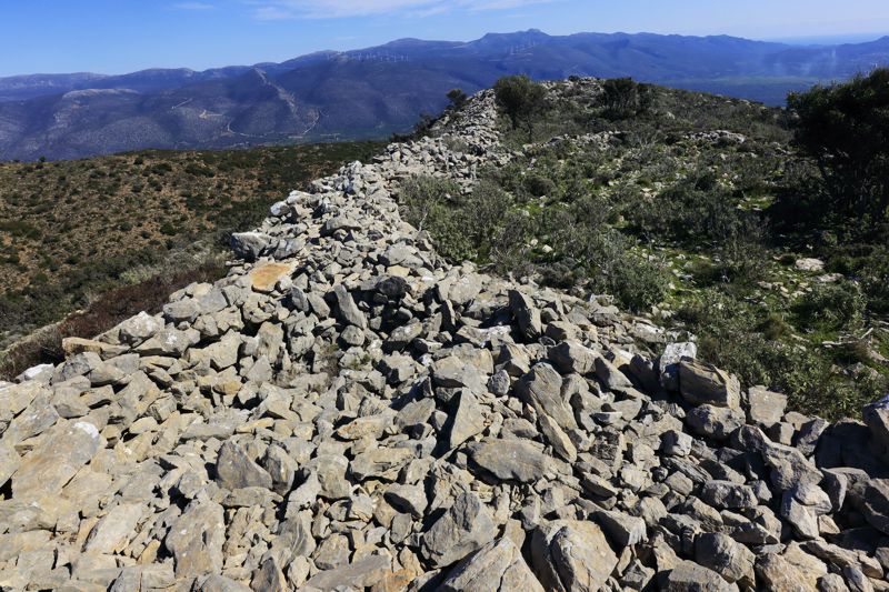
A large fortification on the top of a buttress of the top Strogyla. The buttress is naturally protected with large and vertical slopes on all three sides and the wall mainly covers the northern side.
The wall is made of rough stones and its dating is uncertain. In addition, it seems to have been used a posteriori for various uses, such as for livestock farming, receiving interventions that also can not be dated.
The main advantage of the location is the open view to the plain of Molaoi.
The Paleokastro of Asopos
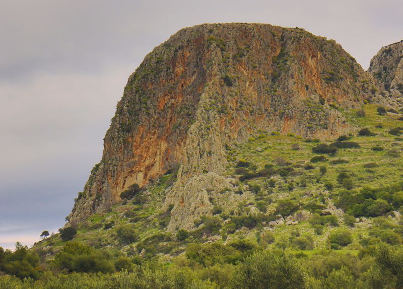
A naturally fortified area on top of a dome-shaped rocky hill to the east of Plytra (ancient city of Asopos). Approach to the hill is along a path on its most accessible side. At the end of the ascent there are steps, carved in the rock and a short newer stairway.
On the plateau one can see the remains of buildings and fortifications and the ruins of a tower. The location has excellent views over the coastline and Molai plain and ensures the visual contact over the towers of Elia and Fonias.
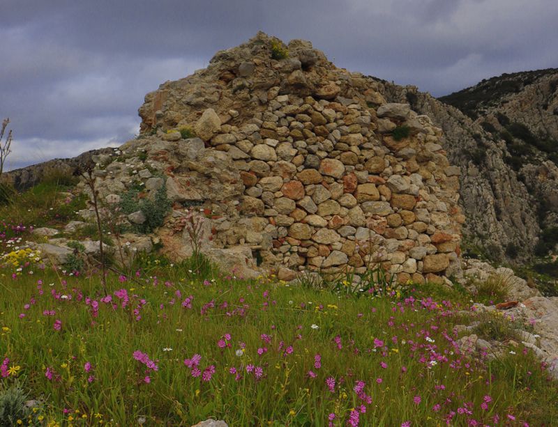
On the south side of the rock there is a robust wall built with a technique of the ancient times. The wall delimits a safe place within a zone of caves.
At the beginning of the path, there is a vaulted medieval water collection tank. This old cistern is still in use.
Castles and towers of Vatika district
Vatika's Castle
Click to enlarge
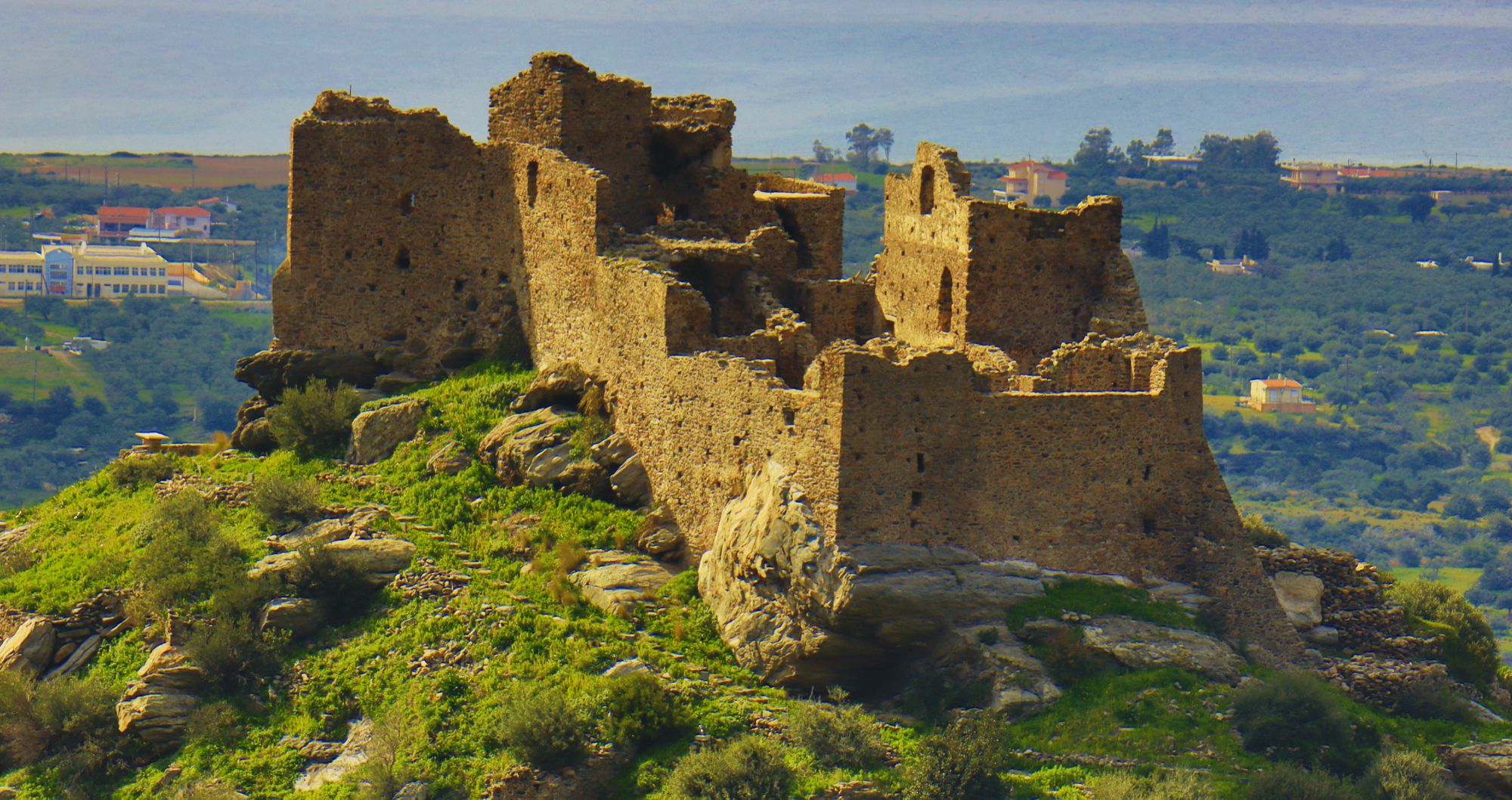
Vatika's Castle is built on top of a steep hill above Neapolis, on the way to the mountainous pass between the villages of Mesochori and Faraklo. The point strategically controls the Laconian Gulf and the wider land. The fort is also called the Castle of Agia Paraskevi or the Castle of Mesochori.
It is not really known when the castle was built, but it seems that its foundation is related to the installation in Vatika of nobles from Monemvasia, in lands granted to them by William Villehardouin, in exchange for the surrender of their city. The area passed into Byzantine hands until its conquest by the Ottoman Turks (1460). Until the beginning of the 19th century, the castle kept on changing hands, along with the area, passing from Venetian to Ottoman control.
Vatika's Castle is today one of the most important fortresses of the Southeastern Peloponnese and is open to visitors. Access is from the north side, where the church of Agia Paraskevi is located. Two fortification precincts are preserved and have been restored, enclosing a series of ruins of churches and houses.
Pantanassa Tower
The influence of fortified Monemvasia in the Byzantine period spread throughout the zone from Vatika to the limits of Mani and Mystras. The western road network converging to Monemvasia was a serpentine way, going among a rough, almost labyrinthine relief, typical of the SE Peloponnese, and passed through several settlements, which too were hooked in defensive or cryptic positions. From time to time, in this complex and hard, streamlined geography, fortresses and watchtowers were built, in order to maintain the safety of the crossings and to provide refuge to travelers. One of these forts is the late Byzantine tower of Pantanassa, which in its time was called the Tower of Elicovouno.
The tower of Pantanassa is a simple two storey watchtower with a rectangular plan measuring 6x4 m. The building is typical of the outdoor towers of the 14th century and has been built with rough stones, with wooden enforcements and abundant mortar. Today it is preserved to a height of up to 4.5 m.
The tower's location was determined by the geometry of the road network between Monemvasia and Vatika and specifically by the branch that passed from Elleniko to Pantanassa and Kryovrysi. Later, locals moved the tower in the spectrum of local mythology and called it the "tower of the Princess", associating it with the princesses of the time of Emperor Andronicus II Palaiologos.
The Fonias Tower
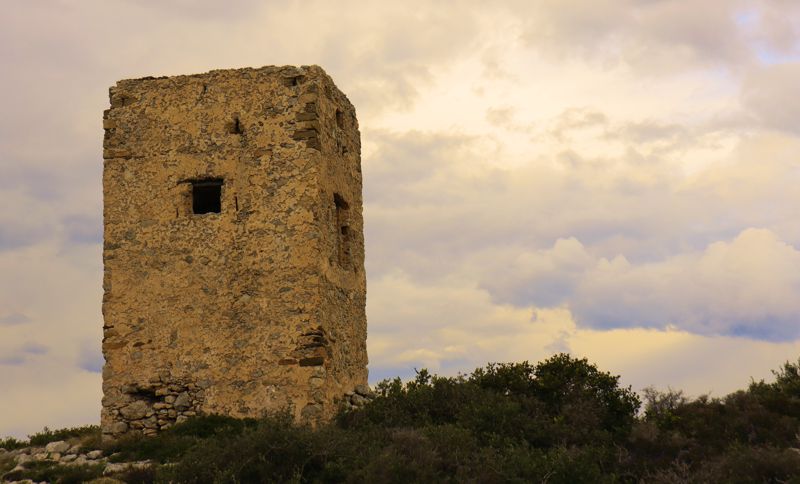
The Fonias Tower was built during the Second Venetian Rule (1690-1715).
The Fonias (= murderer) Tower is located at the highest point on the tip of Cape Lyriotiko and supervises the vulnerable bay of Xyli and the northern side of the bays of Marathias and Limnes. From its position it faces the Koulentianos tower, to which it is possible to transmit messages with fire, smoke or signals.
The tower, which is still in good condition, has a square floor plan with a side of 4.20 m and reaches a height of 7.50 m. Externally it has several openings, such holes for scalding boards, warholes and rifle doors. Internally it is divided into two floors with strong arches, while the accessible roof is protected by a low parapet.
The Koulentianos Tower
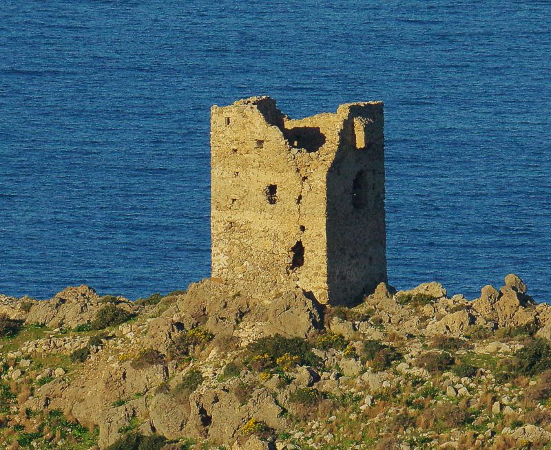
Like the Fonias Tower, the Koulentianos tower basically was not a defensive tower - there was nothing to protect there - but a fortified watchtower.
Standing on the high point of Cape Koulendi, it supervises the coast of Marathias and Limni, up to Skala of Elafonisos. The critical information of the approach of enemies was transmitted by fire and smoke to the tower of Fonias, with which it had direct visual contact, but also to the castle of Vatika, through the watchtower in Viglafia.
The building dates back with relative certainty to the Second Venetian Rule (1690-1715).
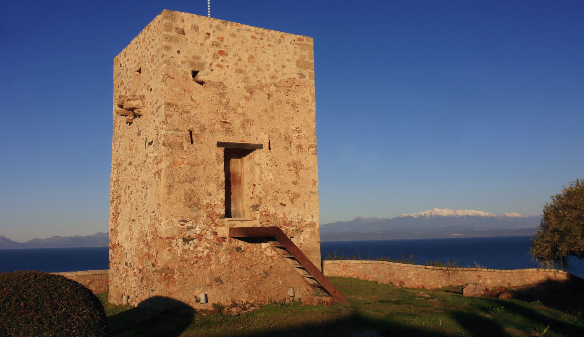
The Elias Tower
Click to enlarge
Tall rectangular tower in the village of Elia. The tower is of similar construction and purpose as the watchtowers of Fonias and Koulentianos, with which it shares also the period of construction. It is built on a plateau above the steep coastal slope, which gives it extra security and better supervision.
Tower of Agios Konstantinos
In the church of Saints Constantine and Kosmas of Aetolos, on a ridge with an open view to the south, are preserved the relics of the rectangular medieval tower.
The location is roughly symmetrical to the location of the Pantanassa Tower, in relation to the old (and newer) axis of communication between Monemvasia and Vatika, which passed through Elliniko and Kryovrysi villages. The location of the tower of Agios Konstantinos, however, does not supervise the old road axis, but the valley of Agios Demetrios (accessible from the village of Sklavouna), through which communication was made with the zone of Kampos of Neapolis - while the tower of Pantanassa supervised the connection with Elika.
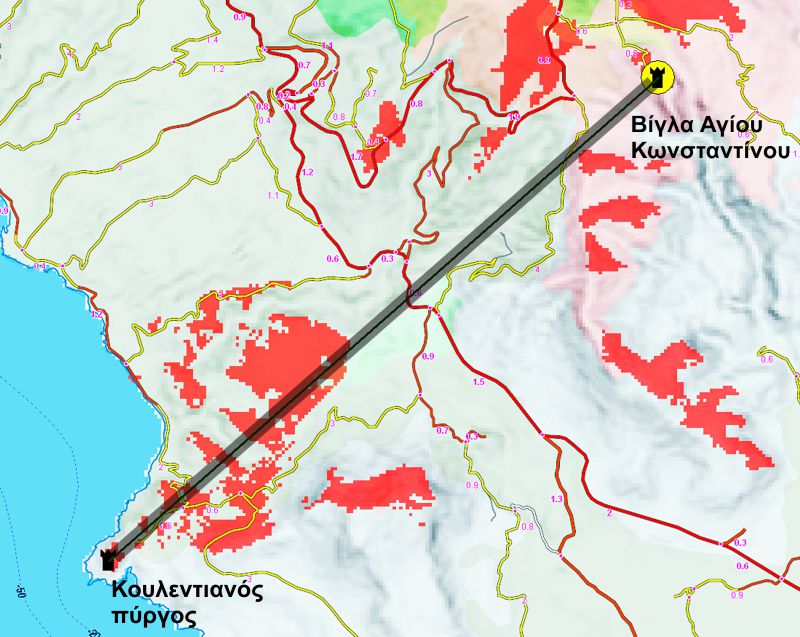
In red the areas visible from the Tower of Agios Konstantinos
Although the relief is quite complex, it seems that the tower of Agios Konstantinos had visual contact with the Koulentianos tower (assuming a building+observer height of about 9 m). The distance between the two towers is 6.7 km. The distance from the castle of Vatika is even greater (10.5 km), which is quite a long distance for visual communication. On the surrounding ridges there are more suitable places for visual interconnections. Therefore, the role of the tower of Agios Konstantinos as a node in the network of communications with visual messages is not obvious. Perhaps it was a defensive tower of an old monastery.
The dating of the tower is placed towards the end of the 17th century. Today, only its first floor is preserved, unfinished. Remarkably, its side has a dimension of 4.2 m., just like the coastal towers of Fonias and Koulentios.
The fort Ai Giannis of Velanidia
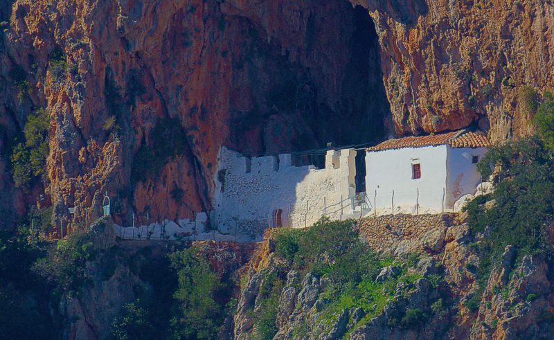
The fort of Ai Giannis of Velanidia consists in one of the many caves of the area that were used for shelter during pirate and land raids.
The location was fortified and the defensive equipment consisted of a narrow passage and a high wall that delimits the protected and potentially habitable area of the cave. The rock shelter, which houses the sizable church of Agios Ioanis, provides satisfactory protection also from the elements of nature.
Both the materials and the building technique of the construction are undated.
The German watchtower of Velanidia
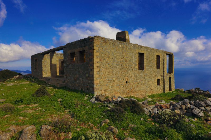
The German watchtower of Velanidia was built during WWII, on a secondary hill of Mount Krithina above the village of Velanidia, by the German forces, with the requisition of a local workforce.
The tower's role was supervisory as it provided guidance to the German ships and planes that crossed the Myrtoo Sea and the Kytherian Sea. The building hosted important telecommunications equipment, through which it supported the boats and aircraft, but also transmitted messages to the southernmost stations of the German troops.
It seems that the watchtower participated in the navigation of the aircraft that took part to the Landing in Crete.
Castles and towers of Gerakas, Richea and Charakas area
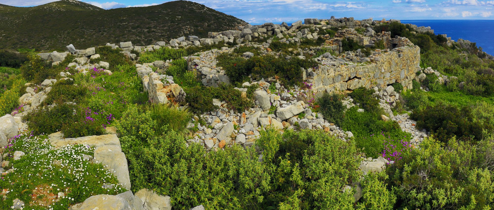
Acropolis of Zarax
Click to enlarge
Large fortified area from the late antiquity with discontinuous use in Roman and Byzantine periods.
Zarax is blessed with one of the most well-protected natural harbors of the Peloponnese. The bay looks like a fjord, dug deaply into the limestone, which protects it from all possible winds and weathers.
On the northern side of the bay, on the edge of a wide, rocky peninsula, the city of Zarax flourished during the Hellenistic period, surrounded by a fortification in which there was a powerful citadel.
The outer wall and the acropolis failed to save the ancient city from destruction and decline. Zarax continued to be inhabited in Roman times, when new buildings were erected, up to the middle of Byzantium, a time to which belong the relics of a three-aisled basilica, a smaller chapel and defensive works. Gradually, the importance of the port and the castle were weakened by the rise of Monemvasia, the strategic value of which was highlighted by modern building techniques and especially by the use of firearms.
Richea's Castle
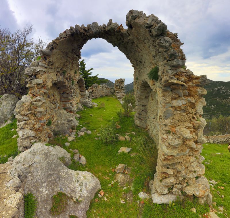
Ruined fortress of the late Byzantine period. It supervises the sea access to the bays of Vathi Avlaki (or Vlychada) and Baloukeri gorge, and was built in order to prevent raids from the sea and to timely notify the residents of Richea.
In the center of the walled area was built the chapel of Agios Demetrios. The walls and relics of various buildings are still preserved, including a renovated Byzantine cistern.
Paleochora of Charakas
Both the location and the fortified area of Paleochora of Charakas are impressive: it is a narrow and barely passable tongue of land, hanging literally over a gorge. In this impregnable shelter was hidden an entire settlement, from which a large part of the walls and a tower, ruins of buildings, cisterns and two ruined churches are visibly preserved. At the edge of the cliff stands the Byzantine church of Prophitis Ilias, where frescoes of the late 14th to early 15th century are preserved.
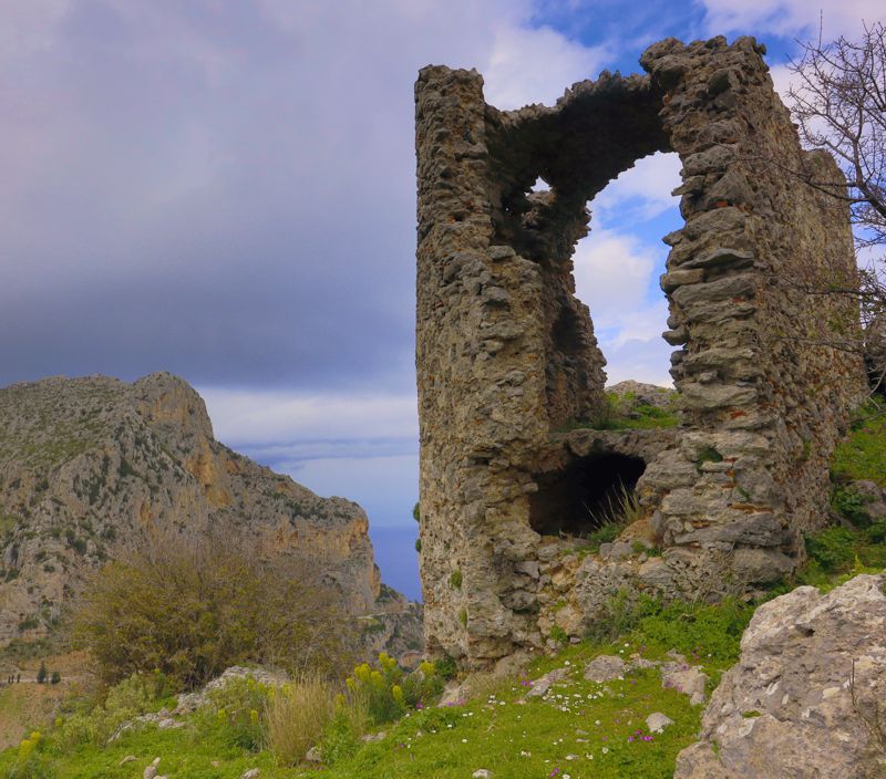
The fort acquired the walls that we see today somewhere in the 13th century. Soon it attracted residents of the area and several centuries later a small village - Charakas - was formed, which experienced continuous habitation from the 13th to the 17th century. Then the inhabitants moved to today's Charakas, leaving the name Paleochora to the fortified settlement.
Text and photos: T. Adamakopoulos
Translation: Andrea Bonetti
Information : www.kastra.eu
topoguide Greece
A GUIDE FOR KYPARISSI, ZARAKAS,
MONEMVASIA, VATIKA AND CAPE MALEAS
The guide Monemvasia topoguide is available for Android devices along with dozens of other regions of Greece, within the general application topoguide Greece. Monemvasia topoguide is a member of the Pelponnese group. Get Monemvasia topoguide as an in-app purchase from the topoguide Greece available regions list.
The Monemvasia topoguide guide is also available for iOS devices (iPhone and iPad) through the general hiker application Topoguide Greece. Get Monemvasia topoguide as an in-app purchase via the available regions list.
It is very interesting that topoguide Greece has the ability to simultaneously display up to 15 different areas, thus allowing an overall view of the Peloponnese and the easy alternation of hundreds of hiking routes, hundreds of Points of Interest and dozens of pages of the guide with innumerable photos.
