Geography of Mt Taygetos
Geography of Mt Taygetos
Text and photos: T. Adamakopoulos
The mountain landscape of the Peloponnese is characterized by lengthy mountain ridges and extensive forests. A bird's-eye view shows that these two elements combine to form a complex but continuous web which, beginning at the wall of the northern mountains, surrounds the Arcadian plateau and ends at the two, southern mountain ranges of Taygetos and Parnon.

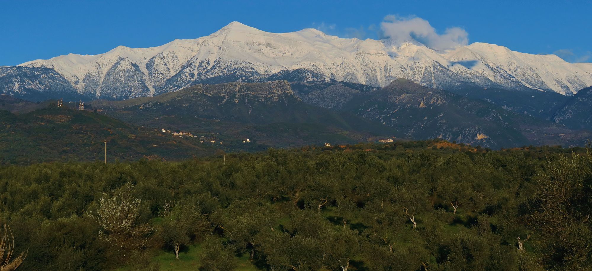
The eastern side of Mt Taygetos ridge (click to enlarge).
The eastern side of Mt Taygetos ridge dominates the LaKonian plaines
The large mountain range of Taygetos begins at the southern end of Arcadia and stretches to the mountains of Mani, through which it reaches deep into the Cretan sea, thus combining both island and mainland characteristics. For the most part it is covered in forests, which are a natural extension of the oak forests of Megalopolitis and ensure continuity with the forest ecosystems of the rest of the Peloponnese. The eastern and western faces of Taygetos are as different as the two worlds of Messenia and Lakonia. Forest cover is thin on the western side. An endless series of bare slopes plunges steeply to rocky shores dotted with frail fishing craft riding the choppy waters. On the Lakonian side, however, water and forests abound, the gorges are divided by small plateaux and pleasant slopes that shelter thriving villages. These pockets of vigorous mountain settlements and fertile plains have ensured the continued existence of the unique civilization of Lakonia.
Villages are scattered along the entire length of the Lakonian side of Taygetos benefiting from the close proximity to rich plains, forest and mountain resources and the variety of contrasting landscapes. The restless inhabitants of Lakonia settled in waves around ancient Sparta, medieval Lakedaimonia and the castle town of Mystras. In the turbulent post-Byzantine years they returned to the natural fortifications of their mountain villages developing a self-sufficient mountain economy. Through the centuries the imposing presence of Mt Taygetos has inspired the work of local writers, poets and artists, while in troubled times it has fortified the indomitable spirit of the Lakonian people. These collective experiences have shaped a vigorous, modern, agricultural community that radiates its ancient cultural identity.
Travel literature, the pictorial arts, poetry and the lowly journalistic pen have all paid homage to eastern Taygetos, whose lofty peaks shrouded in snow tower over the Evrotas valley. The mountain was named after Taygheti, one of the Atlantides whose beauty attracted the lustful gaze of Zeus the ruler of the gods. Torn by shame, Taygheti put an end to her mortal life by leaping off a cliff on the mountain. In another version the goddess Artemis takes pity on her and turns her into a deer that vanishes forever into the forest. During Frankish rule of the Peloponnese the mountain is often called Pentadhaktilon, meaning "five-fingered", presumably referring to the foothills on the eastern face, each of which had a settlement or fortification.
The main axis of the mountain forms an almost straight ridge north to south, from the saddle with Northern Taygetos to the saddle with Saghia. It includes the peaks Neraidhovouni, Spanakaki and Profitis Ilias (2404m), which is the highest point in the range. Large hills branch off to the east and west from this main body. On the western face there are large ravines, the most well known being Ridomo and Viros, which start at the peaks with consecutive, gorge-like formations down to the sea. The largest ravine on eastern Taygetos is Lagadha, which starts at the saddle with northern Taygetos and ends at Maghoulitsa, a tributary of the river Evrotas. The landscape of Eastern Taygetos is more compact and has an unusual feature. Its slopes descend steeply to 800m and then form a large step before sloping to the plain. Deep ravines divide this step into a series of buttresses with a summit towards the plain. The steepest of these is crowned by the castle of Mystra.

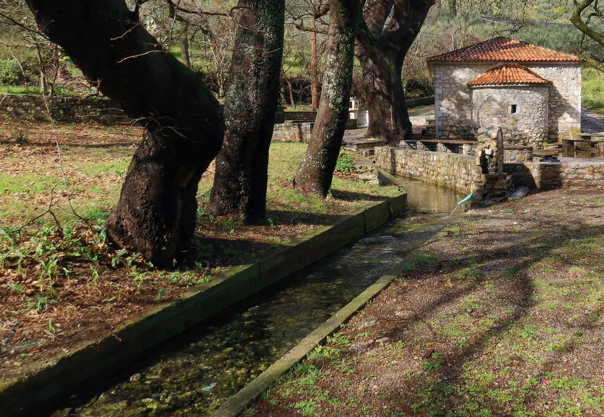
On the eastern feet of the mountain,
chapels and villages point out
the important karstic spings (click to enlarge).
On the eastern feet of the mountain, chapels and villages point out the important karstic spings
Most of the range, and particularly the upper part, is formed of slab-like crystalline limestone with karst erosion in places, although not to the extent found in other mountains of the Peloponnese and Central Greece. Halfway up on the large plateau is extensive evidence of schists, while the rocky outcrops form crystalline limestone masses and dolomites. The distribution of surface water is uneven and while the Messenian side is waterless, the Lakonian side is irrigated by permanent streams and abundant springs where the limestone rock meets the impervious rock layers. Streams on the eastern side of Taygetos collect in large ravines that join the Evrotas River. Evrotas itself stems from the streams of the Arkadian plateau and is reinforced by the waters of the Vivari spring, north of Sparti.

topoguide Greece
Hiking and nature guide
of Mt Τaygetos

Taygetos topoguide is available for Android devices as an in-app-purchase via the global app topoguide Greece. Taygetos topoguide is a member of the Peloponnese group.
Taygetos topoguide is also available as an in-app-purchase for iOS & iPad devices via the global hiking app Topoguide Greece app. There again, Taygetos topoguide is a member of the Peloponnese group.
topoguide Greece offers active guidance along the trail, as well as an extented guidebook on the geography, the nature and the history of the area.

