Menalon Trail in autonomy
Menalon Trail in autonomy
Menalon Trail is a long hiking route of approximately 75 kilometers, spreading between Stemnitsa and Lagadia.
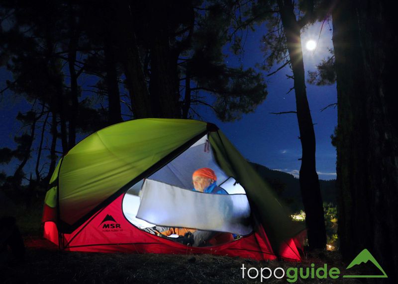
Walking the entire route is a good introduction to the spirit of the Long Distance Trails: these are multi-day and long-hour hikes at a gentle pace, waiting in the village to watch the rain or to recover, carrying a solid rucksack with adjusted light gear, having dinner, overnight stay and breakfast in the tent, select supplies in the dilapidated mini-market of the village, looking for water in the mountain springs.
The number of group members should be very small to achieve maximum cohesion. Otherwise, the group members shouldrespect the privacy and personal preferences of others. A key point of group cohesion is that satisfaction during a Long Distance Trail comes from the degree of integration with the trail and the landscape, not from speed or some other metric.
Perhaps the most secure way to realy enjoy your Long Distance Trail is to walk alone or with just one other person.
As with all Long Distance Trails, on the just-75km Menalon Trail the problem with the two remote start and finish points is that if you drive by your car to the start you have to find a way to get back. In the case of Gortynia district, the only way is by taxi.
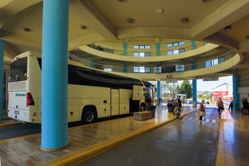
An also practical - if not better - solution is to use the local KTEL (inter-urban bus service). The KTEL buses have developed in Greece a very dense network and serve in a coherent and economical way a variety of transport.
Mainalo Trail is served by the KTEL Arcadias. KTEL Arkadias buses depart from Kifissos station in Athens to go to the service's central hub, Tripolis. From Tripolis, take the local bus go to Stemnitsa or Lagadia, depending on whether you want to do the route in the forward or backward direction.
Usually the buses to the villages leave Tripolis around noon, so taking one of the 2 morning buses from Athens ensures almost all local transfers (the Athens-Tripolis distance is covered in 2h45'). Information and details about the schedules can be found either on the website of KTEL Arkadias or by calling the KTEL offices in Tripoli or Athens.
Stemnitsa-Dimitsana

Click to enlarge
First, introductory, wild, beautiful and adventurous, the path through Lousios valley is the most beautiful and interesting section of the whole Menalon Trail. Fortunately, the uphill part to Dimitsana has a rather gentle slope.
Overnight: At the stadium of Dimitsana or even better in Agia Paraskevi, 20 minutes after Dimitsana.
Dimitsana-Zygovisti-Elati
This 18.5 km long section is a bit monotonous and somewhat tedious, maybe not so for an experienced hiker.
There is a chance to meet loggers near Pliovouni and shepherds (or groups of sheep) in Vlachika. Dogs in Vlachika are indifferent toward hikers.
Trekking poles are probably necessary on the descents from Pliovouni to Vlachika, especially with a heavy backpack.
Elati-Vytina-Nymfasia
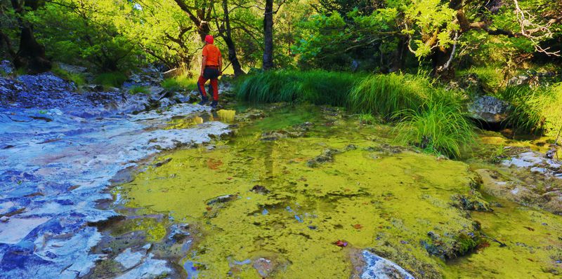
The Elati-Vytina section is both easy and very pleasant. Some old stories about sheepdogs near ancient Methydrio seem to no longer be true. At the second watermill of Mylaon river you can wash clothes in the river or try a (very) rudimentary bath.
In the summer, Vytina is the ideal village to spend the dead hours of a rainy or hot day. The constant and lively movement in the main square is the best wake-up call.
The time distance from Vytina to Nymphasia is only 2 hours (there is some elevation difference though...) and so it is easy to reach Nymphasia in early afternoon.
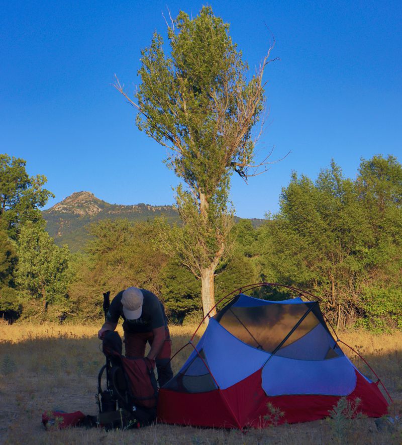
Διανυκτέρευση: The vast flat fields opposite the village cemetery are particularly suitable for camping AND a late departure from the tavern.
Alternatively, you setup your tent on Agios Athanasios hill - awesome view and sunset - just 10 minutes from the square. Also, the area is fenced and nobody and nothing will disturb you.
If for some reason it is necessary to camp near Vytina, there is a very good spot a bit before the town: near the Artotsi fountain there is a large shrine and the beginning of a cobbled path. The path soon leads to the top of a hill, where is the church of Agia Paraskevi. On the level area around the church there is a fountain with water and plenty of space for 1 dozen tents.
Nymphasia-Magouliana-Valtesiniko
The first leg, Elati-Vytina, is rather pleasant, in the shade and quite interesting. The descent from Palea Vytina to the bridge of Tzavarena is also quick and clean. The last section, the ascent to Nymphasia, is both monotonous and tiring - but in the village, the tavern of Panagopoulos is waiting to ... stun us.
From Nymphasia to Sfyrida hermitage, despite the elevation difference, but the terrain is easy. Note however that the next section in the fir forest, up to the Gavros spring is more tiring. Then, up to Magouliana, it's a just walk.
The Magouliana-Valtesiniko section is mild and shady, although the landscape in Potamia is quite monotonous.
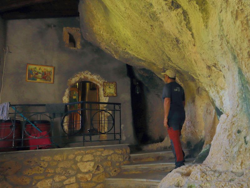
Overnight: There are nice meadows just before Valtesiniko. If you go up to the village for dinner, find the nice spot at the west end of the upper ring road, next to a large metal water tank. Of course, in August, the youth of the village stroll here, but in the other months you won't see anyone. At the turn of the asphalt there is a large stone-built fountain.
Valtesiniko-Lagadia
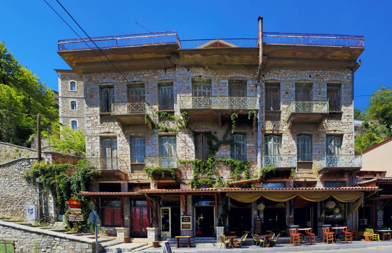
This last section is quite long but not painful. After the uphill leg from Valtesiniko to Agia Triada, there is a long gentle walk up to the Tsapournia Pass.
From Tsapournia Pass, the new way to Grilas is somewhat tiring, but fortunately well marked. The part from Grilas to Lagadia would have been a magnificent triumphant walk if the last leg had not been choked by the bushes.
Overnight: If for some reason it is necessary, near the Grias Lithari spring there are several small flat spots for camping. The last place suitable for setting up a tent is the Panorama Drainas (but there is no water).
Practical issues
Food: Greek honey pastries, ("pasteli"), cereal bars, nuts, french brioche - plus tuna in an envelope - , olives, nuts are perfect for calories. During the day: charcuterie, cheese, dry bread.
Restaurants/taverns in the villages: Stemnitsa has several suggestions, Dimitsana and Vytina many more, Elati only one and rather tight, Magouliana 1-2 good, Nymphasia one very good, Valtesiniko 2 strong proposals; the offers abound in Lagadia.
Photography: mobile phone or camera? Knowing that the mobile phone camera covers 90% of cases with zero added volume and weight, keep also in mind that with the main disadvantages being the small sensor and the lack of an viewfinder, the mobile phone camera does not have the flexibility and capabilities of a dedicated camera. So if you want high quality phtos and videos, consider a small mirrorless camera, which is both light and versatile, such as the Canon M6II, most Fujifilm and Olympus models, the Sony 6000 series, etc.
Recovery in the villages: a visit to the toilet is necessary for some cleaning, change of underwear and a few touches of hygiene. Do not stay in sweaty clothes and especially underwear. Immediately untie the boots and wear them loosely to allow your feet to breathe.
Water resources
The safe water poitns are as follwos:
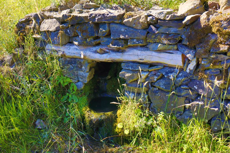
- Stemnitsa-Dimitsana: the fountain in the Prodromos monastery, the fountain in the center of Filosofou monastery, the large springs below the Open Air Water-Power Museum (flowing on the ground ...), the tapin Paliohori (a bit out of the way).
- Dimitsana-Zygovisti: there are no springs on the route. Many fountains and taps in Dimitsana and Zygovisti.
- Zygovisti-Elati: Piso Vrysi in Zygovisti, the fountain in Agiorgis chapel, the spring in Bourniades, the spring of Bourboulistra, the impressive fountain in Paleochori, the spring in Lakkomata. Koskitsa spring has no longer water and Plioneri is far out of the way.
- Elati-Vytina: the spring in Lakkomata, Pyrgaki fountain, Artotsi fountain. You cannot get water from the Methydrion springs. Mylaon's water is clean enough for cooking and washing, but not for drinking.
- Vytina-Nymphasia: The spring Vrysoula no longer has water. At the bridge of Tzavarena, Mylaon's water (when it has water ...) is not drinkable.
- Nymphasia-Magouliana: In the Gavros spring you can get water in the small building. You will find water in the Kernitsa monastery (in the chapel) and in Sfyrida hermitage.
- Magouliana-Valtesiniko: The Korfoxylia spring does not flow freely (you may be able to get water inside the small building). Get water from the fountain of Malikas, close to Valtesiniko.
- Valtesiniko-Lagadia: Krya Vrysi spring is a bit out of the way, but has plenty of water all year round. The Koubliza spring is dripping, but you can't get water. Karvounovrysi has water until August, but it actually flows into the gully. The most reliable source on this section is Grias Lithari spring (and Agia Triada spring, 500 m off the route). There area two or three small springs along the way, but they cannot provide drinking water.
The tent
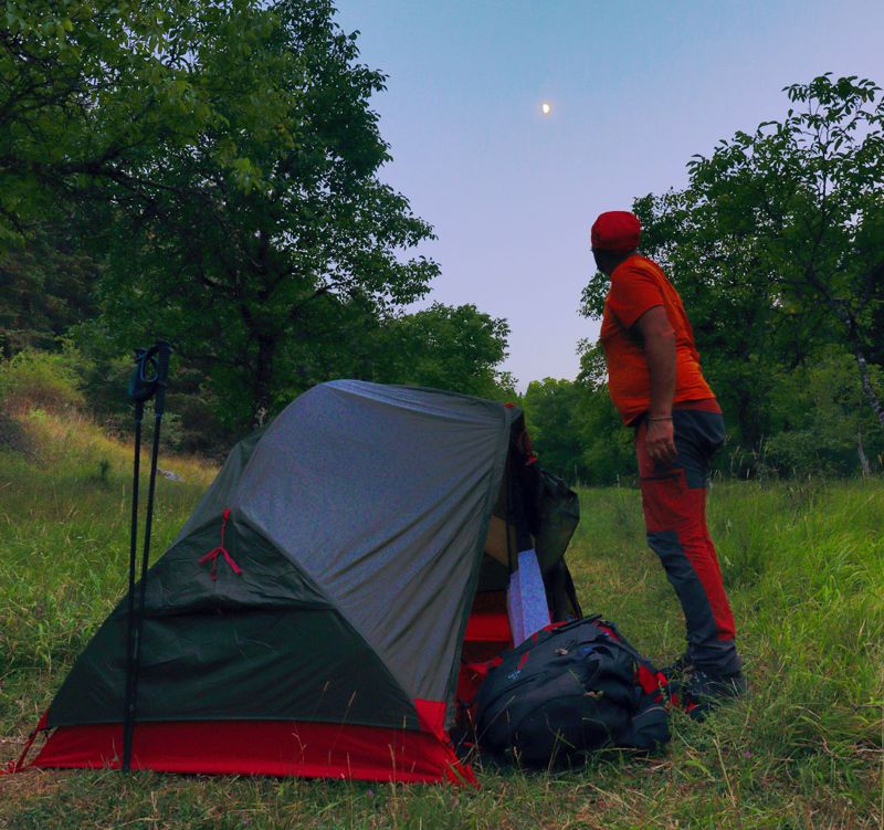
There are suitable places to set up a tent everywhere in the way. Of course, do prefer places near springs or fountains. In any case: do not leave garbage or other pollutants (use the toilets in cafes and restaurants).
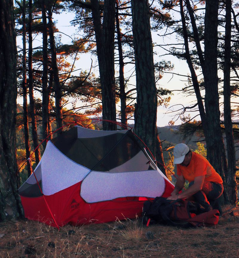
The tent should be as small and light as possible, especially if one is alone. If we have originally planned to stay overnight near villages or chapels, we can rely on a shelter in case of bad weather and not carry the outer cover of the tent.
An ideal tent for Greece, practically for all seasons, is MSR's hubba hubba (in the photos ...). Almost all companies have similar small and light tents, with Decathlon's proposal being closer in size and weight.
Text and photos by T. Adamakopoulos

topoguide Greece
Menalon Trail topoguide
The digital field guide Menalon Trail topoguide is available for Android devices as an in-app purchase within the application topoguide Greece. Menalon Trail is a member of the Long Trails group.
The digital field guide Menalon Trail topoguide is also available for iOS (iPhone and iPad) devices as an in-app purchase within the application Topoguide Greece. There also, Menalon Trail is a member of the Long Trails group.
Menalon Trail topoguide offers active guidance along the trail, as well as an extented guidebook on the geography, the nature and the history of the area.

