

The Mycenaean Way
Hiking in Mycenae
The Mycenaean Way

The Mycenaean Way
(πατήστε για μεγέθυνση).
The Mycenaean Way
Σήμερα, που το οδικό δίκτυο συνδέει ταχύτατα - και διασπά βίαια - το χώρο, είναι κάπως δύσκολο να φανταστεί κανείς ποιά ήταν η ζωτική έκταση των προϊστορικών Μυκηνών. Βλέπουμε τον αργολικό κάμπο, κατάφυτο από εσπεριδοειδή, βερυκοκιές και αροτριαίες καλλιέργειες και δεν μπορούμε να φανταστούμε ότι αυτά τα φυτά δεν υπήρχαν καν στην περίοδο ακμής του μυκηναϊκού πολιτισμού. Ακόμα και η ελιά είχε μόλις εγκαταστεθεί και ευδοκιμήσει.
Με τα σημερινά δεδομένα είναι δύσκολο να εντάξει κανείς τα οροπέδια της Οροσειράς της Νυφίτσας, εγκαταλελειμένα εδώ και δεκαετίες, στον πυρήνα του παραγωγικού πλέγματος των Μυκηνών. Και όμως, η σταθερότητα της διατροφικής βάσης της προϊστορικής πόλης εξαρτώταν από πολλαπλούς, απομακρυσμένους και διάσπαρτους γεωργικούς πόρους, στους οποίους κατέληγε ένας πολύκλαδος ιστός από μονοπάτια.
Το βασικότερο μονοπάτι, ένας πραγματικός δρόμος της εποχής, συνέδεε τις Μυκήνες με την παρακείμενη λεκάνη της Πρόσυμνας, όπου υπήρχαν πολλοί ενδιαφέροντες φυσικοί πόροι: πηγές, πηγάδια, ρεματιές με ροή, ελαιώνες, γεωργικές εκτάσεις που δεν πλημμύριζαν και άλλα. Οι Μυκηναίοι είχαν εγκαταστήσει ένα μικρό οικισμό στο μικρό λόφο, που μοιάζει και λέγεται Μαστός.
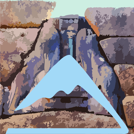
Ο δρόμος Μυκηνών-Πρόσυμνας είναι ο καλύτερα διατηρημένος από τους δρόμους της μυκηναϊκής εποχής. Από μια εύνοια της συντυχίας, δύο σκέλη του και δύο από τα κύρια τεχνικά έργα του - δύο προϊστορικά γεφύρια - σώθηκαν από τη λαίλαπα αγροτικών δρόμων που σάρωσε την περιοχή. Η Μυκηναϊκή διαδρομή που προτείνουμε πιο κάτω κινείται πάνω στον πανάρχαιο αυτό δρόμο και τις σημερινές προεκτάσεις του.
The trail starts from the entrance of the archeological site of Mycenae and follows the local roads to the eastern end of the citadel. Follow a shortcut (well marked with red marks): on our right, in the Kermes oaks and the lentiscs is hidden the Dragonera bridge, one of the some 20 bridges of the Mycenaean era known today.
Cross a junction (the road on the left goes up to Agiolias) and continue until the location where the red signs indicate the beginning of the path. Cross the olive grove and reach the ancient cobbled path. Pass the Lykotroupi bridge and continue until reaching an alley.
Enter soon a narrow alley in the olive grove and descend it steadily, until reaching a larger dirt road. The dirt road converges with the asphalt of the valley and leads to Prosymna. In the last part one could see the ruins of the great Roman baths and one of the towers of the fortification of Prosymna in classical times.
Text and photos: T. Adamakopoulos
Waymarking
Signposts and marks

There are many direction signs of the Ephorate of Antiquities with the inscription "Mycenaean Road".
The trail is fairly well marked with red markings on trees and rocks.
Culture
Mycenaean bridges

This technique of the crushing arch was applied to the dozens of bridges that were located in the 19th and 20th century in Argolida and implemented in seasonal streams, marshes and ravines, such as the bridges in Dragonera and Lykotroupi.
It is possible that these constructions were the implementation of specific specifications on roads that may have been considered of strategic significance.
topoguide Greece
A GUIDE FOR THE TRAVELING
ALONG THE MYCENAEAN LANDSCAPE
The guide Mycenae topoguide is available for Android devices along with dozens of other regions of Greece, within the general application topoguide Greece. Mycenae topoguide is a member of the Pelponnese group. Get Mycenae topoguide as an in-app purchase from the topoguide Greece available regions list.
The Mycenae topoguide guide is also available for iOS devices (iPhone and iPad) through the general hiker application Topoguide Greece. Get Mycenae topoguide as an in-app purchase via the available regions list.
It is very interesting that topoguide Greece has the ability to simultaneously display up to 15 different areas, thus allowing an overall view of the Peloponnese and the easy alternation of hundreds of hiking routes, hundreds of Points of Interest and dozens of pages of the guide with innumerable photos.
