Keramidi-Kanalia
North Pelion
Keramidi-Kanalia
The Keramidi-Kanalia trail follows the old mule track between Keramidi and the area of Lake Karla and Volos. This long path has been broken up when the main road network of the area was opened, sometime in the 1960s.
From the square of Keramidi, where the large church of Agios Georgios is located, we walk along paved streets until the exit of the settlement. At the first ravine we will enter the path to Veneto. In the beinning, the trail follows a dirt road and then becomes a clear cobbled path. We meet the asphalt road on a ridge, where a large sheepfold facility and a small gully.

North Pelion topoguide
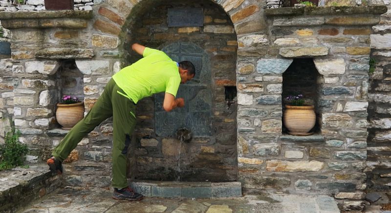
The Agios Georgios fountain, main square of Keramidi
The Agios Georgios fountain, main square of Keramidi
The dirt road skirts an open basin. This curve in the road can be shortened by a well-maintained path through the meadows. At the axis of a ravine we see the signposts and the beginning of the path to Kanalia.

North Pelion topoguide
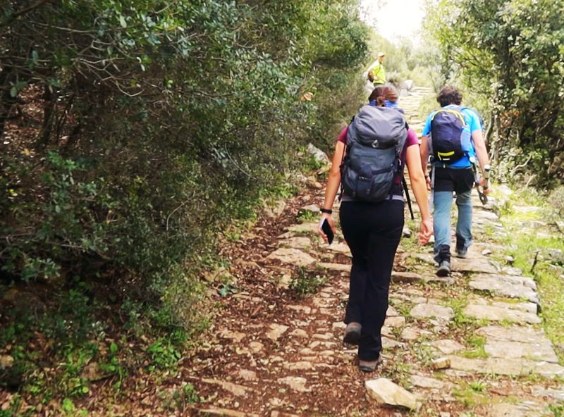
On the Keramidi-Kanalia trail
On the Keramidi-Kanalia trail
After a shortcut on a path, cross the tarmac road and enter an earth path that runs gently towards the old Ano Kanalia. Along the small plateau, there are two chapels and remains of houses, as well as newer recreational facilities and a water fountain.
Rejoin the asphalt road and follow it for 1.6 km. Continue on the old path, which crosses the road and descends steeply towards Kanalia.
The path is splitted but the main course is quite obvious and somewhat marked and brings us to the upper part of Kanalia, where the Chatzidimi fountain is located. Cross the village via small alleys and end up at the lower point of the housing area.
Text and photos: T. Adamakopoulos
Nature
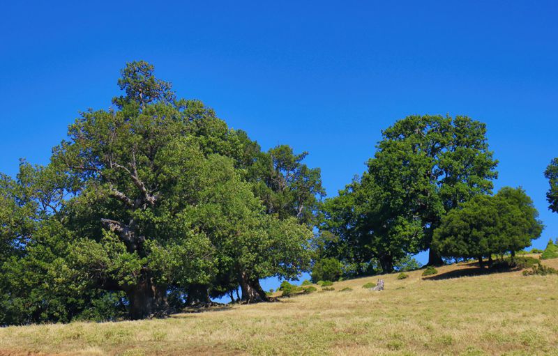
Oak forest in North Pelion

From the Flamouri monastery and up to Mt Kissavos, the upper zone, ranging from 500 to 1000 m, is covered by a discontinuous oak forest where several species coexist, but is definitely dominated by Hungarian oaks (Quercus frainetto).
Quercus frainetto is a large deciduous tree, reaching heights of 38 metres, with a trunk girth of nearly 2 m. The bark is light gray in colour and cracks into small square plates.
The leaves are large and about 20 cm long, divided into 6–10 very deep parallel lobes.
The centre of the tree's native range is in the Balkans. The main factor of its occurrence at a particular site is the soil. It is specially adapted to heavy acidic soils, which usually are very dry in the summer and sometimes waterlogged in the spring. It is also extremely sensitive to the presence of lime in the soil, so its distribution in Greece is limited to the presence of flysch and schist.

topoguide Greece
GUIDES TO MT PELION

Decriptions, mapping, photos and metrics for the Keramidi-Kanalia route are included in the guide North Pelion topoguide, created by AnaDigit.
North Pelion topoguide is available for Android devices along with dozens of guides of other regions of Greece, within the hiking application topoguide Greece. Get North Pelion topoguide as an in-app purchase through the application.
North Pelion topoguide is also available for iOS (iPhone και iPad) devices within the hiking application Topoguide Greece. Get the North Pelion topoguide as an in-app purchase via the application.
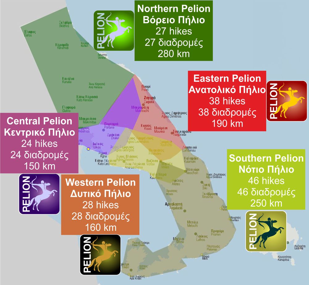
North Pelion is a member of the Central Greece topoguides group.
It is very interesting that topoguide Greece has the ability to simultaneously display many areas, thus allowing the overall view of the detailed map of the whole of Mt Pelion and the easy alternation of the routes, the Points Of Interest and the dozens of pages of the guide with the countless photos.

